Indaparapeo
Indaparapeo | |
|---|---|
 Cultural centre in Indaparapeo | |
 Coat of arms | |
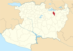 Location in Michoacán | |
 Indaparapeo Location in Mexico | |
| Coordinates: 19°47′16″N 100°58′07″W / 19.78778°N 100.96861°WCoordinates: 19°47′16″N 100°58′07″W / 19.78778°N 100.96861°W[1] | |
| Country | |
| State | |
| Established | 10 December 1831 |
| Seat | Indaparapeo |
| Government | |
| • President | María Teresa Pérez Romero |
| Area | |
| • Total | 176.985 km2 (68.334 sq mi) |
| Elevation [1] (of seat) | 1,921 m (6,302 ft) |
| Population (2010 Census)[3] | |
| • Total | 16,427 |
| • Estimate (2015 Intercensal Survey)[4] | 16,990 |
| • Density | 93/km2 (240/sq mi) |
| • Seat | 6,791 |
| Time zone | UTC-6 (Central) |
| • Summer (DST) | UTC-5 (Central) |
| Postal codes | 58970–58978[5] |
| Area code | 451 |
| Website | Official website |
Indaparapeo is a municipality in the Mexican state of Michoacán, located approximately 25 kilometres (16 mi) east of the state capital of Morelia.
Geography[]
The municipality of Indaparapeo is located in the Trans-Mexican Volcanic Belt in northeast Michoacán at an elevation between 1,900 and 2,900 metres (6,200–9,500 ft). It borders the municipalities of Zinapécuaro to the north, Queréndaro to the east, Tzitzio to the south, Charo to the southwest, and Álvaro Obregón to the northwest.[6] The municipality covers an area of 176.985 square kilometres (68.334 sq mi)[3] and comprises 0.30% of the state's area.[6]
As of 2009, the land in Indaparapeo consists of farmland (41%), temperate forest (41%), grassland (9%), rainforest (5%), and urban areas (3%).[6] About 95% of the entire municipality is located in the Lerma River basin, while the southernmost part is drained by the , a tributary of the Cutzamala River.
Indaparapeo has a temperate climate with rain in the summer.[2] Average temperatures in the municipality range between 18 and 20 °C (64–68 °F), and average annual precipitation ranges between 700 and 1,200 millimetres (28–47 in).[6]
| Climate data for Quirio weather station at 19°47′51″N 100°59′42″W / 19.79750°N 100.99500°W, 1858 m above sea level (1981–2010 averages, 1951–2010 extremes) | |||||||||||||
|---|---|---|---|---|---|---|---|---|---|---|---|---|---|
| Month | Jan | Feb | Mar | Apr | May | Jun | Jul | Aug | Sep | Oct | Nov | Dec | Year |
| Record high °C (°F) | 33.5 (92.3) |
33.0 (91.4) |
34.5 (94.1) |
37.5 (99.5) |
38.0 (100.4) |
38.0 (100.4) |
36.0 (96.8) |
34.0 (93.2) |
34.0 (93.2) |
33.5 (92.3) |
34.0 (93.2) |
32.0 (89.6) |
38.0 (100.4) |
| Average high °C (°F) | 23.2 (73.8) |
25.0 (77.0) |
27.1 (80.8) |
29.2 (84.6) |
30.0 (86.0) |
27.7 (81.9) |
25.5 (77.9) |
25.4 (77.7) |
25.3 (77.5) |
25.5 (77.9) |
25.1 (77.2) |
23.9 (75.0) |
26.1 (79.0) |
| Daily mean °C (°F) | 14.2 (57.6) |
15.4 (59.7) |
17.3 (63.1) |
19.7 (67.5) |
21.3 (70.3) |
21.0 (69.8) |
19.5 (67.1) |
19.3 (66.7) |
19.1 (66.4) |
18.0 (64.4) |
16.1 (61.0) |
14.8 (58.6) |
18.0 (64.4) |
| Average low °C (°F) | 5.2 (41.4) |
5.9 (42.6) |
7.5 (45.5) |
10.2 (50.4) |
12.5 (54.5) |
14.2 (57.6) |
13.5 (56.3) |
13.2 (55.8) |
12.9 (55.2) |
10.4 (50.7) |
7.2 (45.0) |
5.7 (42.3) |
9.9 (49.8) |
| Record low °C (°F) | −3.0 (26.6) |
−3.0 (26.6) |
−2.0 (28.4) |
2.0 (35.6) |
4.0 (39.2) |
6.0 (42.8) |
8.5 (47.3) |
7.5 (45.5) |
3.0 (37.4) |
1.0 (33.8) |
−2.0 (28.4) |
−5.5 (22.1) |
−5.5 (22.1) |
| Average precipitation mm (inches) | 16.2 (0.64) |
12.6 (0.50) |
8.0 (0.31) |
12.1 (0.48) |
32.3 (1.27) |
113.3 (4.46) |
158.8 (6.25) |
143.2 (5.64) |
119.0 (4.69) |
44.7 (1.76) |
8.0 (0.31) |
5.6 (0.22) |
673.8 (26.53) |
| Average rainy days (≥ 1 mm) | 3.0 | 1.7 | 1.7 | 3.4 | 6.6 | 16.0 | 21.9 | 20.4 | 16.8 | 7.7 | 2.7 | 1.7 | 103.6 |
| Source: Servicio Meteorológico Nacional[7][8] | |||||||||||||
History[]
In the Purépecha language, Indaparapeo has been translated to mean "place of games" or "place of victory in combat"; the latter would appear to be a reference to the Tarascans defeating the Aztecs. Prior to Spanish contact, Indaparapeo was inhabited by the Matlatzinca people, who were allies of the Tarascans.[2]
Indaparapeo was one of the 61 municipalities initially created in Michoacán in 1831. Its original extent has been reduced by the creation of several municipalities from its territory, namely Queréndaro in 1921, Álvaro Obregón in 1930 and Tzitzio in 1936.[2][9]
Administration[]
The municipal government comprises a president, a councillor (Spanish: síndico), and seven trustees (regidores), four elected by relative majority and three by proportional representation.[2] The current president of the municipality is María Teresa Pérez Romero.[10]
Demographics[]
In the 2010 Mexican Census, the municipality of Indaparapeo recorded a population of 16,427 inhabitants living in 3791 households.[11] The 2015 Intercensal Survey estimated a population of 16,990 inhabitants in Indaparapeo.[4]
There are 39 localities in the municipality,[1] of which two are classified as urban:
- the municipal seat also known as Indaparapeo, which recorded a population of 6791 inhabitants in the 2010 Census; and
- San Lucas Pío, located 5 kilometres (3.1 mi) east of the municipal seat on Mexican Federal Highway 126, which recorded a population of 3056 inhabitants in the 2010 Census.[11]
Economy[]
Important economic activities in Indaparapeo include agriculture and brickmaking.[2][12]
References[]
- ^ a b c "Sistema Nacional de Información Municipal" (in Spanish). SEGOB. 2010. Retrieved 26 December 2020.
- ^ a b c d e f "Indaparapeo". Enciclopedia de los Municipios y Delegaciones de México (in Spanish). INAFED. Retrieved 26 December 2020.
- ^ a b c "Indaparapeo: Datos generales". Cédulas de información municipal (in Spanish). SEDESOL. 2013. Retrieved 26 December 2020.
- ^ a b Panorama sociodemográfico de Michoacán de Ocampo 2015 (PDF) (in Spanish). INEGI. 2016. p. 68. ISBN 978-607-739-850-9. Retrieved 26 December 2020.
- ^ "Consulta de Códigos Postales". Catálogo Nacional de Códigos Postales. Mexican Postal Service. 25 December 2020. Retrieved 26 December 2020.
- ^ a b c d "Indaparapeo, Michoacán de Ocampo" (PDF). Prontuario de información geográfica municipal de los Estados Unidos Mexicanos (in Spanish). INEGI. 2009. Retrieved 26 December 2020.
- ^ "NORMALES CLIMATOLÓGICAS" (in Spanish). Servicio Meteorológico Nacional. Retrieved 26 December 2020.
- ^ "NORMALES CLIMATOLÓGICAS" (in Spanish). Servicio Meteorológico Nacional. Retrieved 26 December 2020.
- ^ Estado de Michoacán de Ocampo. División Territorial de 1810 a 1995 (PDF) (in Spanish). Mexico: INEGI. 1996. pp. 82, 141–143. ISBN 970-13-1501-4.
- ^ Aparicio, Beatriz (25 September 2018). "Configuración política de Michoacán 2018-2021". Alcaldes de México (in Spanish). Retrieved 26 December 2020.
- ^ a b "Resumen municipal: Municipio de Indaparapeo". Catálogo de Localidades (in Spanish). SEDESOL. Retrieved 26 December 2020.
- ^ Inventario físico de recursos minerales del municipio Indaparapeo, Michoacán (PDF) (Report) (in Spanish). Mexican Geological Survey. August 2007. pp. 19–23. Retrieved 26 December 2020.

- Municipalities of Michoacán
- 1831 establishments in Mexico
- States and territories established in 1831