Independence Hills
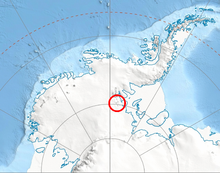
The Independence Hills (80°25′S 81°33′W / 80.417°S 81.550°WCoordinates: 80°25′S 81°33′W / 80.417°S 81.550°W) are a line of rugged hills and peaks, 10 miles (16 km) long, with mainly bare rock eastern slopes. They lie 3 miles (5 km) southeast of the Marble Hills and form the southern segment of the west wall of Horseshoe Valley, in the Heritage Range of Antarctica. The Independence Hills were mapped by the United States Geological Survey from ground surveys and U.S. Navy air photos, 1961–66. The name was applied by the Advisory Committee on Antarctic Names in association with the name "Heritage Range".[1]
 WikiMiniAtlas
Features[]
Geographical features include:
References[]
- ^ "Independence Hills". Geographic Names Information System. United States Geological Survey. Retrieved 2012-07-06.
![]() This article incorporates public domain material from the United States Geological Survey document: "Independence Hills". (content from the Geographic Names Information System)
This article incorporates public domain material from the United States Geological Survey document: "Independence Hills". (content from the Geographic Names Information System)
| General |
|  |
|---|---|---|
| Regions | ||
| Waterways | ||
| Famous explorers | ||
This Ellsworth Land location article is a stub. You can help Wikipedia by . |
- Hills of Ellsworth Land
- Ellsworth Land geography stubs