Independence Peak
| Independence Peak | |
|---|---|
| Revolution Peak | |
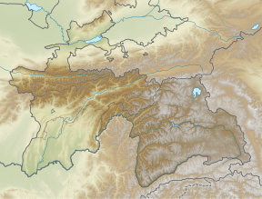 Independence Peak Location in Tajikistan | |
| Highest point | |
| Elevation | 6,940 m (22,770 ft)[1] |
| Prominence | 2,402 m (7,881 ft)[1] |
| Isolation | 55.3 km (34.4 mi) |
| Listing | Ultra |
| Coordinates | 38°30′36″N 72°21′15″E / 38.51000°N 72.35417°ECoordinates: 38°30′36″N 72°21′15″E / 38.51000°N 72.35417°E[1] |
| Geography | |
| Location | GBAO, Tajikistan |
| Parent range | Pamir Mountains |
| Climbing | |
| First ascent | 1954, by A. Ugarov et al. |
| Easiest route | glacier/snow climb |
Independence Peak or Qullai Istiqlol (Tajik: Қуллаи Истиқлол), at 6,940 m (22,769 ft), is the seventh-highest peak in the Pamir Mountains,[2] located at the center of Tajikistan's Gorno-Badakhshan Autonomous Province, above the source of the in the Yazgulem Range. The mountain consists of three snow- and ice-covered summits and its northwest face is the source of the Fedchenko Glacier.
The peak was originally named Dreispitz by a joint Russian–German team who discovered it in 1928, but failed to climb it due to deep snow and avalanche danger. The first ascent was made in 1954 by a Russian team led by A. Ugarov. After World War II, Dreispitz was renamed Revolution Peak (Tajik: Қуллаи Инқилоб, Qullai Inkilob), and in July 2006 it was given its current name.
See also[]
References[]
- ^ a b c "The Central Asian Republics: Ultra-Prominence Page". Peaklist.org. Retrieved 2014-05-26.
- ^ High Asia - All mountains and main peaks above 6650 m www.8000ers.com. Retrieved 2017-02-05
External links[]
- A description of Revolution Peak and its surroundings, with images
- "Revolution Peak". Peakware.com. Archived from the original on 2016-03-04.
- Revolution Peak renamed Independence Peak by Resolution No. 297 of the Government of the Republic of Tajikistan, July 4, 2006.
This Tajikistan location article is a stub. You can help Wikipedia by . |
- Mountains of Tajikistan
- Six-thousanders of the Pamir
- Tajikistan geography stubs