Jászladány
show This article may be expanded with text translated from the corresponding article in Hungarian. (December 2013) Click [show] for important translation instructions. |
Jászladány | |
|---|---|
Large village | |
 Coat of arms | |
 Jászladány | |
| Coordinates: 47°21′53″N 20°09′52″E / 47.36472°N 20.16444°ECoordinates: 47°21′53″N 20°09′52″E / 47.36472°N 20.16444°E | |
| Country | |
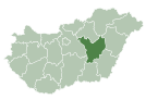
| County | Jász-Nagykun-Szolnok |
| District | Jászapáti |
| Area | |
| • Total | 92.73 km2 (35.80 sq mi) |
| Population (2013) | |
| • Total | 5,642 |
| • Density | 60.8/km2 (157/sq mi) |
| Time zone | UTC+1 (CET) |
| • Summer (DST) | UTC+2 (CEST) |
| Postal code | 5055 |
| Area code(s) | (+36) 57 |

Jászladány is a large village in Jász-Nagykun-Szolnok county,[1] in the Northern Great Plain region of central Hungary.
Geography[]
It covers an area of 92.73 km2 (36 sq mi) and has a population of 5,642 people (2013 estimate).[2]
Population[]
| Year | 1980 | 1990 | 2001 | 2010 | 2011 | 2013 |
|---|---|---|---|---|---|---|
| Population | 6,659 (census)[2] | 6,028 (census)[2] | 6,194 (census)[2] | 5,861 (estimate)[3] | 5,614 (census)[2] | 5,642 (estimate)[2] |
References[]
- ^ "Jászladány City Info". CitySeek.org. Retrieved 8 December 2013.
- ^ Jump up to: a b c d e f "Jászladány Population Table". citypopulation.de. Retrieved 8 December 2013.
- ^ "Helységnévkönyv adattár 2010". KSH (Hungarian Central Statisctical Office). 1 January 2010. Archived from the original on 7 November 2012. Retrieved 8 December 2013.
External links[]
![]() Media related to Jászladány at Wikimedia Commons
Media related to Jászladány at Wikimedia Commons
- Official website in Hungarian

| Authority control: National libraries |
|---|
This Jász-Nagykun-Szolnok location article is a stub. You can help Wikipedia by . |
Categories:
- Populated places in Jász-Nagykun-Szolnok County
- Jászság
- Jász-Nagykun-Szolnok geography stubs