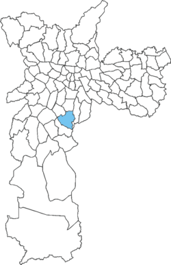
Jabaquara (district of São Paulo)
Coordinates: 23°38′11″S 46°38′45″W / 23.6364°S 46.6459°W

Jabaquara | |
|---|---|
 District of the city of São Paulo | |
| Country | |
| State | |
| Municipality | |
| Subprefecture | Jabaquara |
| Area | |
| • Total | 14.10 km2 (5.44 sq mi) |
| Population (2007) | |
| • Total | 223,780 |
| • Density | 15,871/km2 (41,110/sq mi) |
| Website | Subprefecture of Jabaquara |
Jabaquara is one of 96 districts in the city of São Paulo, Brazil.[1] The name Jabaquara comes from tupi-guarani YAB-A-QUAR-A, which means rock or hole.
References[]
- ^ "Dados Demográficos dos Distritos pertencentes as Subprefeituras". prefeitura.sp.gov.br (in Portuguese). City of São Paulo. Archived from the original on 4 February 2015. Retrieved 28 December 2014.

This geographical article relating to the state of São Paulo is a stub. You can help Wikipedia by . |
Categories:
- Districts of São Paulo
- São Paulo (state) geography stubs