Jack Knife Fire
| Jack Knife Fire | |
|---|---|
 Jack Knife Fire on June 22, 2018 | |
| Location | Kent, Oregon, United States |
| Coordinates | 45°16′19″N 120°36′47″W / 45.272°N 120.613°WCoordinates: 45°16′19″N 120°36′47″W / 45.272°N 120.613°W |
| Statistics[1] | |
| Date(s) | June 20, 2018 – July 6, 2018 |
| Burned area | 15,676 acres (63 km2) |
| Map | |
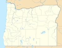 Location of fire in Oregon. | |

The Jack Knife Fire was a wildfire five miles north of Kent, Oregon in the United States. The fire was started by lightning on June 20, 2018, around 3:00 pm, just west of the John Day River. The fire burned 15,676 acres (63 km2).
Events[]
The Jack Knife fire was started on June 20, 2018, by a lightning strike, along the John Day River, five miles north of Kent, Oregon. The fire was one of 70 wildfires started in Oregon due to lightning strikes over a two-day period. By June 23, the fire had spread to 2,000 acres (8 km2), moving along the river and north to Wilson Point and south to Adobe Point.[2]
By June 26, the fire had grown to 15,676 acres (63 km2) as the result of hot and dry weather. It was contained on July 6.[1]
References[]
- ^ a b "Jack Knife Fire". InciWeb. US Bureau of Land Management. Retrieved 24 June 2018.
- ^ "Update June 23, 2018 Jack Knife Fire - InciWeb the Incident Information System". inciweb.nwcg.gov. Retrieved 24 June 2018.
![]() This article incorporates public domain material from this U.S government document.
This article incorporates public domain material from this U.S government document.
| Pre-2000 | |
|---|---|
| 2000–2015 |
|
| 2017 |
|
| 2018 | |
| Post-2018 | |
| |
This Oregon-related article is a stub. You can help Wikipedia by . |
This wildfire-related article is a stub. You can help Wikipedia by . |
- 2018 Oregon wildfires
- June 2018 events in the United States
- Sherman County, Oregon
- Oregon stubs
- Wildfire stubs