Jacka Glacier
| Jacka Glacier | |
|---|---|
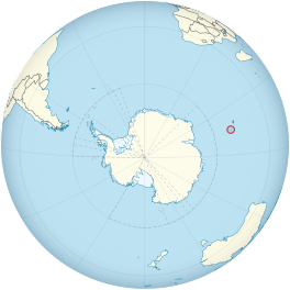 Location of Heard Island and McDonald Islands on the globe | |
| Location | Heard Island and McDonald Islands |
| Coordinates |  53°6′S 73°24′E / 53.100°S 73.400°E / -53.100; 73.400 53°6′S 73°24′E / 53.100°S 73.400°E / -53.100; 73.400 |
| Length | 0.8 nmi (1 km; 1 mi) |
| Thickness | unknown |
| Terminus | north coast |
| Status | unknown |
Jacka Glacier ( WikiMiniAtlas53°0′S 73°20′E / 53.000°S 73.333°E / -53.000; 73.333) is a 0.8-mile (1.3 km) long glacier which flows northeast from Hayter Peak and terminates in icefalls opposite Vanhoffen Bluff on the north side of Heard Island in the southern Indian Ocean. The glacier appears to be roughly charted on an 1860 sketch map compiled by Captain , an American sealer operating in the area during this period. It was surveyed in 1948 by the Australian National Antarctic Research Expeditions, and named by them for , an expedition physicist.[1]
See also[]
- List of glaciers in the Antarctic
- Glaciology
References[]
- ^ "Jacka Glacier". Geographic Names Information System. United States Geological Survey. Retrieved 2012-07-13.
External links[]
![]() This article incorporates public domain material from the United States Geological Survey document: "Jacka Glacier". (content from the Geographic Names Information System)
This article incorporates public domain material from the United States Geological Survey document: "Jacka Glacier". (content from the Geographic Names Information System)
Glaciers | |||||||
|---|---|---|---|---|---|---|---|
| Types |
| ||||||
| Anatomy |
| ||||||
| Processes |
| ||||||
| Measurements |
| ||||||
| Volcanic relations | |||||||
| Landforms |
| ||||||
| |||||||
Glaciers in the Antarctic | |
|---|---|
|
Glaciers of Heard Island and McDonald Islands | |
|---|---|
|
This article about a glacier in a subantarctic island is a stub. You can help Wikipedia by . |
- v
- t
- Glaciers of Heard Island and McDonald Islands
- Subantarctic island glacier stubs
- Coordinates on Wikidata
- Wikipedia articles incorporating text from the USGS Geographic Names Information System
- All stub articles