Japan National Route 8
show This article may be expanded with text translated from the corresponding article in Japanese. (January 2020) Click [show] for important translation instructions. |
 | ||||
|---|---|---|---|---|
| 国道8号 | ||||
 | ||||
| Route information | ||||
| Length | 574.1 km[1] (356.7 mi) | |||
| Existed | 1952–present | |||
| Major junctions | ||||
| North end | ||||
| South end | ||||
| Highway system | ||||
| National highways of Japan Expressways of Japan
| ||||
National Route 8 (国道8号, Kokudō hachi-gō) is a major highway in the Hokuriku and Kansai regions of central Japan. The 574.1-kilometer (356.7 mi) highway begins at an intersection with National Routes 7, 17, 49, 113, and 116 in Chūō-ku, Niigata. It travels southwest across central Honshu, connecting the prefecture capitals: Toyama, Kanazawa, Fukui, and Ōtsu. In Kyoto it travels concurrently with National Route 1 toward its endpoint at an intersection with National Routes 9, 24, and 367 in Shimogyō-ku, Kyoto.[2][3]
Route description[]

Left:Hokuriku Expressway
Center:National Route 8 and JR Hokuriku Main Line
Right: Niigata Prefecture Route 525
- Length: 574.1 km (356.7 mi)
- Origin: Chūō-ku, Niigata (originates at junction with Routes 7, 17, 49, 113 and 116)
- Terminus: Shimogyō-ku, Kyoto (ends at Junction with Routes 9, 24 and 367)
- Major cities: Sanjō, Nagaoka, Kashiwazaki, Joetsu, Itoigawa, Toyama, Takaoka, Kanazawa, Hakusan, Komatsu, Fukui, Tsuruga, Maibara, Hikone, Ōtsu
History[]
The origins of the road that is now National Route 8 can be traced back to the Hokurikudō, a road that was established after the Taika Reform to link Kyoto to the capitals of the region by that went by the same name.[4]
The modern history of the highway saw its establishment by the Cabinet of Japan on 4 December 1952 as First Class National Highway 8 from Niigata to Kyoto. On 1 April 1965 it was re-designated as General National Highway 8. On 7–9 February 2018, heavy snowfall shut down the highway for over 60 hours in Fukui Prefecture before it could be removed.[5]
Intersecting routes[]
- in Niigata Prefecture
- in Toyama Prefecture
- in Ishikawa Prefecture
- in Fukui Prefecture
- in Shiga Prefecture
- in Kyoto Prefecture
- Routes 9, 24 and 367
In popular culture[]
National Route 8 is the namesake of , a chain of ramen shops in the Hokuriku region.[6]
Gallery[]

Masaya-koji Street, near the origin of Route 8 in Niigata City

Nagaoka Bypass in Nagaoka, Niigata Prefecture
Route 8 in Joetsu, Niigata Prefecture

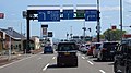
Route 8 in Komatsu, Ishikawa

Route 1 and Route 8 in Rittō, Shiga Prefecture


See also[]
 Japan portal
 Roads portal
References[]
- ^ "一般国道の路線別、都道府県別道路現況" [Road statistics by General National Highway route and prefecture] (PDF) (in Japanese). Ministry of Land, Infrastructure, Transport and Tourism. Retrieved 19 February 2020.
- ^ 一般国道8号 (in Japanese). Kinki Regional Development Bureau, Ministry of Land, Infrastructure, Transport and Tourism. Retrieved 27 November 2010.
- ^ 一般国道8号 (in Japanese). Kinki Regional Development Bureau, Ministry of Land, Infrastructure, Transport and Tourism. Retrieved 27 November 2010.
- ^ "北陸道/ほくりくどう" (in Japanese). Retrieved 30 January 2020.
- ^ "大雪で立ち往生、ようやく解消 福井の国道8号" [Stuck with heavy snow, National Highway 8 is finally reopened in Fukui] (in Japanese). 9 February 2018. Retrieved 11 December 2018.
- ^ "Hachi-ban Ramen History". Retrieved 30 January 2020.
External links[]
 Media related to Category:Route 8 (Japan) at Wikimedia Commons
| show |
|---|
This article relating to the roads and highways in Japan is a stub. You can help Wikipedia by . |
- National highways in Japan
- Roads in Fukui Prefecture
- Roads in Ishikawa Prefecture
- Roads in Kyoto Prefecture
- Roads in Niigata Prefecture
- Roads in Shiga Prefecture
- Roads in Toyama Prefecture
- Japan road stubs