Jardine River National Park
| Jardine River National Park Queensland | |
|---|---|
IUCN category II (national park) | |
 Jardine River National Park | |
| Nearest town or city | Weipa |
| Established | 16 December 1994 |
| Area | 2,370 km2 (915.1 sq mi) |
| Managing authorities | Queensland Parks and Wildlife Service |
| Website | Jardine River National Park |
| See also | Protected areas of Queensland |
The Jardine River National Park is a national park in Queensland, Australia, 2,137 km (1,328 mi) northwest of Brisbane and about 900 km (559 mi) northwest of Cairns, on the tip of Cape York Peninsula.[1]
The park and reserves encompass the traditional country of several Aboriginal groups including people from the , Angkamuthi, Yadhaykenu, Gudang and Wuthathi language and social groups. The area is a living cultural landscape, with places and features named in Aboriginal languages, story-places and story-beings, and occupation and ceremony sites throughout. Today the traditional owners retain a strong and continuing interest, through their traditional rights to, and responsibilities for, the land, in the protection and management of the area.[2]
Coastal features[]
Coastal features include:[3]
- The southern half of Orford Bay
- Orford Ness
- False Orford Ness
- Hunter Point
Vegetation[]
The Jardine River National Park features a complex array of vegetation types, many of which, with the exception of minor occurrences in limited zones close to the south, do not exist elsewhere. [4] The forest types which occur in the National Park can be broken down into nine broad categories:
Closed Forests[]
Simple notophyll vine forest - Simple notophyll vine forest with and Melaleuca species - Araucarian vine forest - Mesophyll palm forest.[4]
Closed Scrub[]
Asteromyrtus lysicephala scrub - Ericaceae (Epacridaceae) scrub.[4]
Closed Heath[]
heathland.[4]
Closed Sedgeland[]
sedgeland.[4]
Open Forest[]
Eucalyptus nesophila forest - Eucalyptus nesophila / Eucalyptus tetrodonta forest - Eucalyptus tetrodonta forest.[4]
Low Open Forest[]
Asteromyrtus symphyocarpa / Leptospermum fabricia forest.[4]
Open Heath[]
Nepenthes mirabilis / Asteromyrtus lysicephala heath.[4]
Tall Shrubland[]
Melaleuca viridiflora shrubland - Grevillea glauca shrubland with Eucalyptus species.[4]
Low Open Shrubland[]
Baeckea frutescens / Asteromyrtus lysicephala shrubland.[4]
Waterfalls[]
The park contains several waterfalls and rock pools, including , where the waters of Elliot River and Canal Creek meet, , and .
Gallery[]
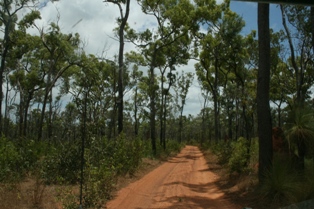
Jardine River National Park

Fruit Bat Falls


See also[]
- Protected areas of Queensland
References[]
- ^ Hema, Maps (2007). Australia Road and 4WD Atlas (Map). Eight Mile Plains Queensland: Hema Maps. p. 104. ISBN 978-1-86500-456-3.
- ^ Qld. Govt. Department of National Parks - Jardine River
- ^ "Wuthathi Tumra Region - Schedule 2" (PDF). June 2008. Retrieved 5 February 2022.
- ^ a b c d e f g h i j ; Stanton, J. P. (James Peter), 1940- (1976), Vegetation of the Jardine River catchment and adjacent coastal areas, the Royal Society of Queensland, pp. 39–48
{{citation}}: CS1 maint: multiple names: authors list (link)
External links[]
- Trek Earth Image of Fruit Bat Falls
- Trek Lens Image of Fruit Bat Falls
This Queensland protected areas related article is a stub. You can help Wikipedia by . |
This Far North Queensland geography article is a stub. You can help Wikipedia by . |
- IUCN Category II
- National parks of Far North Queensland
- Protected areas established in 1994
- 1994 establishments in Australia
- Queensland protected area stubs
- Far North Queensland geography stubs