Jasikan District
Jasikan District | |
|---|---|
 Districts of Oti Region | |
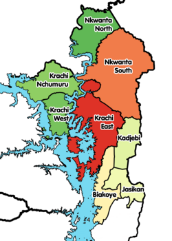
 Jasikan District Location of Jasikan District within Oti | |
| Coordinates: 7°24′39.6″N 0°28′4.8″E / 7.411000°N 0.468000°E | |
| Country | |
| Region | |
| Capital | Jasikan |
| Government | |
| • District Executive | Hon. Lawrence Kwami Aziale |
| Area | |
| • Total | 1,355 km2 (523 sq mi) |
| Population (2019) | |
| • Total | 72,607[1] |
| Time zone | UTC+0 (GMT) |
| ISO 3166 code | GH-OT-JA |

Jasikan District is one of the eight districts in Oti Region, Ghana.[2][3] Originally created as an ordinary district assembly on 10 March 1989, which was created from the former Jasikan District Council, which it was established by Legislative Instrument (L.I.) 1464, until the western part of the district was split off to create Biakoye District on 29 February 2008, which was established by Legislative Instrument (L.I.) 1901; thus the remaining part has been retained as Jasikan District. The district assembly is located in the southern part of Oti Region and has Jasikan as its capital town.
Boundaries[]
Jasikan District is bounded by:
- Lake Volta to the west,
- Kpando Municipal District and Hohoe Municipal District to the south, and
- Krachi East District and Kadjebi District to the north.
Towns and Villages[]
In addition to Jasikan, the capital and administrative centre, Jasikan District contains the following towns and villages in Buem in alphabetical order.
- Agbesi Madro
- Agomeyor
- Akpafu Todzi
- Akpafu Adorkor
- Akpafu Mempeasem
- Amenyo Yaw
- Akaa
- Akaa Quarters
- Akaa Tank
- Akaa Yaw
- Atakrom
- Atonkor
- Awoma
- Baglo Buem
- Bodada
- Baglo Odumasi
- Dzoku
- Dzolu
- Guama
- Idjeli
- Kayadah
- Kankyi Ekura
- Kudje
- Kute
- Kwanta
- Kwansim
- Lekanti
- New Ayoma
- New Baika
- Nsuta
- Nananko
- Okadjakrom
- Old Baika
- Old Ayoma
- Osei Krom
- Teteman
Education[]
Jasikan College of Education is one of the College's in Oti Region.
See also[]
External links[]
References[]
- ^ "Ghana Statistical Services". statsghana.gov.gh. Retrieved 2020-05-27.
- ^ "One District One Factory (1D1F)". www.1district1factory.gov.gh. Retrieved 2020-05-27.
- ^ Jasikan District
| Municipal (2) |
| |
|---|---|---|
| Ordinary (6) |
| |
Coordinates: 7°24′39.6″N 0°28′4.8″E / 7.411000°N 0.468000°E
- Districts of the Oti Region