Jbel Tidirhine
| Mount Tidighin | |
|---|---|
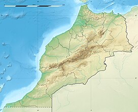 Tidighin Location in Morocco | |
| Highest point | |
| Elevation | 2,456 m (8,058 ft)[2] |
| Prominence | 1,901 m (6,237 ft)[2] |
| Listing | List of Ultras of Africa |
| Coordinates | 34°51′0″N 4°30′36″W / 34.85000°N 4.51000°WCoordinates: 34°51′0″N 4°30′36″W / 34.85000°N 4.51000°W[1] |
| Naming | |
| Native name | جبل تيدغين (Arabic) |
| Geography | |
| Location | Tanger-Tetouan-Al Hoceima, Morocco |
| Parent range | Rif |
| Climbing | |
| First ascent | Unknown |
| Easiest route | From Issaguen |
Mount Tidighin, Jbel Tidighin,[3] Adrar N Tidighin, is a mountain in Al Hoceïma Province, Tanger-Tetouan-Al Hoceima, Morocco. Its summit elevation is 2,456 m.[4]
Geography[]
The Tidirhine is the highest mountain of the Rif Range. It is an ultra-prominent peak that rises above the town of Ketama, now known as Issaguen, in an area known for the hospitality of the local Berber people, as well as for cannabis cultivation.[5] It is located 320 km to the north of Morocco's geographical centre and 232 km northeast of the capital Rabat.
References[]
External links[]
| High Atlas |
|
|---|---|
| Middle Atlas |
|
| Anti-Atlas |
|
| Saharan Atlas |
|
| Rif |
|
| Other peaks & ranges |
|
| |
Categories:
- Mountains of Morocco
- Geography of Tanger-Tetouan-Al Hoceima
- Tanger-Tetouan-Al Hoceima geography stubs