Jefferson Parish, Louisiana
Jefferson Parish | |
|---|---|
Parish | |
| Parish of Jefferson | |
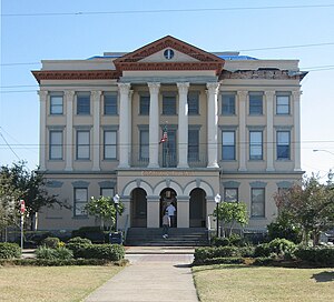 City Hall in Gretna | |
 Location within the U.S. state of Louisiana | |
 Louisiana's location within the U.S. | |
| Coordinates: 29°44′N 90°06′W / 29.73°N 90.1°W | |
| Country | |
| State | |
| Founded | February 11, 1825 |
| Named for | Thomas Jefferson |
| Seat | Gretna |
| Largest community | Metairie |
| Area | |
| • Total | 665 sq mi (1,720 km2) |
| • Land | 296 sq mi (770 km2) |
| • Water | 370 sq mi (1,000 km2) 56% |
| Population (2020) | |
| • Total | 440,781 |
| • Density | 660/sq mi (260/km2) |
| Time zone | UTC−6 (Central) |
| • Summer (DST) | UTC−5 (CDT) |
| Area code | 504,985 |
| Congressional districts | 1st, 2nd, 6th |
| Website | www |

Jefferson Parish (French: Paroisse de Jefferson; Spanish: Parroquia de Jefferson) is a parish in the U.S. state of Louisiana. As of the 2020 U.S. census, the population was 440,781.[1] The parish seat is Gretna.[2] Jefferson Parish is included in the Greater New Orleans area.
History[]
1825 to 1940[]
Jefferson Parish was named in honor of U.S. President Thomas Jefferson[3] of Virginia when the parish was established by the Louisiana Legislature on February 11, 1825, a year before Jefferson died. A bronze statue of Jefferson stands at the entrance of the General Government Complex on Derbigny Street in Gretna. The parish seat was in the city of Lafayette, until that area was annexed by New Orleans in 1852. In that year the parish government moved to Carrollton, where it remained for twenty-two years.[4]
Originally, this parish was larger than it is today, running from Felicity Street in New Orleans to the St. Charles Parish line. However, as New Orleans grew, it absorbed the cities of Lafayette, Jefferson City, Carrollton, and several unincorporated areas (faubourgs). These became part of Orleans Parish. The present borders between Jefferson Parish and Orleans Parish were set in 1874. The Jefferson Parish seat was moved to Gretna at the same time.[5]
NOTE: The historic city of Lafayette in Jefferson Parish, as it was recorded in U.S. census records until 1870, should not be confused with Lafayette, Louisiana, in Lafayette Parish.
1940 to 2000[]
From the 1940s to the 1970s, Jefferson's population swelled with an influx of middle-class white families from Orleans Parish. The parish's population doubled in size from 1940 to 1950 and again from 1950 to 1960 as the parents behind the post–World War II baby boom, profiting from rising living standards and dissatisfied with their old neighborhoods, chose relocation to new neighborhoods of detached single-family housing. By the 1960s, rising racial tensions in New Orleans complicated the impetus behind the migration, as many new arrivals sought not only more living space but also residence in a political jurisdiction independent from New Orleans proper.
The earliest postwar subdivisions were developed on the Eastbank of Jefferson Parish ("East Jefferson") along the pre-existing Jefferson Highway and Airline Highway routes, often relatively far-removed from the New Orleans city line, as land prices were lower further away from New Orleans and land assembly was easier. The completion of Veterans Highway in the late 1950s, following a route parallel to Airline but further north, stimulated more development. The arrival of I-10 in the early 1960s resulted in the demolition of some homes in the Old Metairie neighborhood, where development began in the 1920s, but resulted in even easier access to suburban East Jefferson.
In the portion of Jefferson Parish on the Westbank of the Mississippi River ("West Jefferson"), large-scale suburban development commenced with the completion, in 1958, of the Greater New Orleans Bridge crossing the Mississippi River at downtown New Orleans. Terrytown, within the city limits of Gretna, was the first large subdivision to be developed. Subsequent development has been extensive, taking place within Harvey, Marrero, Westwego and Avondale.
Similar to the development trajectory observed by other U.S. suburban areas, Jefferson began to enjoy a significant employment base by the 1970s and 1980s, shedding its earlier role as a simple bedroom community. In East Jefferson, the Causeway Boulevard corridor grew into a commercial office node, while the Elmwood neighborhood developed as a center for light manufacturing and distribution. By the mid-1990s, Jefferson Parish was exhibiting some of the symptoms presented by inner-ring suburbs throughout the United States. Median household income growth slowed, even trailing income growth rates in New Orleans proper, such that the inner city began to narrow the gap in median household income, a gap at its widest at the time of the 1980 census. St. Tammany Parish and, to a lesser extent, St. Charles Parish began to attract migrants from New Orleans, and increasingly even from Jefferson Parish itself. These trends were catalyzed by Hurricane Katrina, which destroyed much of New Orleans' low-income housing and propelled further numbers of lower-income individuals into Jefferson Parish.
Despite these challenges, Jefferson Parish still contains the largest number of middle class residents in metropolitan New Orleans and acts as the retail hub for the entire metro area.
Hurricane Katrina (2005)[]
Even though Jefferson Parish was affected by Hurricane Katrina, it has rebounded more quickly than Orleans Parish, since the devastation was not as severe. The parish has a current population of 432,000, which is 15,000 fewer people than was recorded by the 2000 U.S. census. New Orleans' Katrina-provoked population loss has resulted in Jefferson Parish becoming the second most populous parish behind East Baton Rouge Parish, center of the Baton Rouge metropolitan area.
With the landfall of Hurricane Katrina on August 29, 2005, Jefferson Parish took a hard hit. On the East Bank, widespread flooding occurred, especially in the eastern part of the parish, as well as much wind damage. Schools also were reported to have been severely damaged. On the West Bank, there was little to no flooding, though there was still much wind damage. As a result, the temporarily moved the parish government to Baton Rouge. Evacuees of Jefferson Parish were told that they could expect to be able to go back to their homes starting Monday, September 5, 2005 between the hours of 6 a.m. CDT and 6 p.m. CDT, but would have to return to their places of evacuation because life in the area was not sustainable. There were no open grocery stores or gas stations, and almost the entire parish had no electric, water, or sewerage services. Moreover, evacuations out of New Orleans were continuing to be staged from the heart of Metairie at the intersection of Interstate 10 and , and traffic throughout the area was primarily restricted to emergency and utility vehicles.
On September 4, Jefferson Parish President Aaron Broussard broke down on Meet the Press[6]
RUSSERT: You just heard the director of Homeland Security’s explanation of what has happened this last week. What is your reaction?
BROUSSARD: We have been abandoned by our own country. Hurricane Katrina will go down in history as one of the worst storms ever to hit an American coast. But the aftermath of Hurricane Katrina will go down as one of the worst abandonments of Americans on American soil ever in U.S. history. … Whoever is at the top of this totem pole, that totem pole needs to be chainsawed off and we’ve got to start with some new leadership. It’s not just Katrina that caused all these deaths in New Orleans here. Bureaucracy has committed murder here in the greater New Orleans area and bureaucracy has to stand trial before Congress now....
Three quick examples. We had Wal-Mart deliver three trucks of water. FEMA turned them back. They said we didn’t need them. This was a week ago. FEMA, we had 1,000 gallons of diesel fuel on a Coast Guard vessel docked in my parish. When we got there with our trucks, FEMA says don’t give you the fuel. Yesterday — yesterday — FEMA comes in and cuts all of our emergency communication lines. They cut them without notice. Our sheriff, Harry Lee, goes back in, he reconnects the line. He posts armed guards and said no one is getting near these lines…
I want to give you one last story and I’ll shut up and let you tell me whatever you want to tell me. The guy who runs this building I’m in, Emergency Management, he’s responsible for everything. His mother was trapped in St. Bernard nursing home and every day she called him and said, "Are you coming, son? Is somebody coming?" and he said, "Yeah, Mama, somebody's coming to get you." Somebody's coming to get you on Tuesday. Somebody's coming to get you on Wednesday. Somebody's coming to get you on Thursday. Somebody's coming to get you on Friday… and she drowned Friday night. She drowned Friday night! [Sobbing] Nobody's coming to get us. Nobody's coming to get us…[citation needed]
By the following weekend, the local electrical utility, Entergy, had restored power to large swaths of Jefferson Parish, and the parish public works department had restored water and sewer service to most of the areas with power. East Jefferson General Hospital never ceased operation, even through the storm. Nevertheless, Mr. Broussard continued to discourage residents from returning until all major streets were clear of downed trees, powerlines and major debris. The parish's initial focus was on helping businesses through the "Jumpstart Jefferson" program that allowed business operators into the parish before residents. Nevertheless, some independent-minded residents began moving back into the parish even before Broussard issued a formal "all-clear", and some gas stations, grocery stores, restaurants and a Home Depot were in operation during this time.
Broussard's report of the events he discussed on Meet the Press have subsequently proven to be inaccurate. The son of the drowned woman was later identified as Thomas Rodrigue, who replied, "No, no, that's not true," when told of Broussard's account. An MSNBC interview with the man revealed that Rodrigue tried to contact his mother at the St. Rita nursing home on the days before the storm – Saturday, August 27 and Sunday, August 28, not Monday through Friday as Broussard had claimed—to encourage the home to evacuate. They did not, resulting in the deaths by drowning of more than 30 other residents.
Crucially, Jefferson's levees and floodwalls did not fail in the wake of Katrina, enabling floodwaters to be rapidly pumped out. As of October 2006, Jefferson Parish had, in effect, completely rebounded from Hurricane Katrina, while far more damaged Orleans Parish continued recovering at a slower rate. Estimates of Jefferson Parish's population ranged from 420,000 to 440,000, and this figure was expected to continue to rise as evacuated residents from Orleans Parish returned to metropolitan New Orleans.[7]
[]
Flooding on the east bank has been frequently attributed to the decision by parish leadership to deactivate the stormwater pumping systems and evacuate the operators during the storm. Katrina's substantial storm surge may have swamped even operating pumping stations but Broussard's activation of the parish's "Doomsday Plan" is the most frequently cited reason for the flooding in all areas of the east bank except Old Metairie and parts of Harahan. Pump operators were evacuated to areas outside the parish that were themselves severely affected by the storm and pump station personnel were consequently unable to immediately return to restart the pumps. They did not arrive until the morning of August 31. Water resulting from the backflow through the non-operating pumping stations, as well as storm-related rainwater, remained on the streets and in the homes of residents of Metairie and Kenner for a day and a half. Many homes which were not severely damaged by storm winds took heavy flood damage, especially along both sides of the West Esplanade canal, from the 17th Street Canal to Kenner. The parish has subsequently announced that it will change the way it evacuates critical personnel during an emergency, both through the construction of "safe-houses" and use of existing facilities on the west bank of Jefferson Parish. The original "safe-house" project was severely modified due to rising costs and was further delayed due to a conflict of interest revealed by the original contractors. There are also plans to add manual closures on the pumping stations due to the failure of the compressed air systems during Katrina's storm surge.
Much additional consideration has been given to the different problem of the flooding in Old Metairie that resulted from Jefferson Parish's reliance on the failed Orleans Parish drainage system at the 17th Street Canal and its Pumping Station No. 6. Flooding in this area south of Metairie Road between the Orleans Parish line and Causeway Boulevard was catastrophic and deep water destroyed much of the most expensive real estate in the parish. A temporary plan was devised to pool water at the Pontiff Playground and south of Airline Drive and to divert some into other Jefferson Parish drainage canals. A longer-term project to divert water from this vulnerable area into the Mississippi River has also been suggested, although its expense appears to be prohibitive. Jefferson Parish officials have also struggled to maximize the parish's ability to utilize the significantly reduced pumping capacity of the 17th Street Canal if the threat of storm surge again requires the Corps of Engineers to close the mouth of the canal.
Gretna controversy[]
The city of Gretna, Louisiana, the parish seat of Jefferson Parish, made news after its police force participated, along with Crescent City Connection Police and Jefferson Parish Sheriff's deputies, in a road block on the Crescent City Connection Bridge in the days following Hurricane Katrina. The purpose was to stop evacuees from crossing over into the evacuated communities on the Westbank of the Mississippi River. Gretna Police had charge of Westbank-bound lanes, while Jefferson Parish deputies controlled the east bank-bound lanes and the bridge police closed the transit lanes.
Initially, as many as 6,000 evacuees were permitted to cross and were shuttled out of the area on buses; however, that operation was eventually discontinued as available fuel supplies were exhausted. Without transportation or sufficient supplies of food or water, west bank law enforcement personnel determined that they were unable to further assist the evacuees. It was also believed at that time that federal relief efforts and supplies were soon to be concentrated in the downtown area of New Orleans. The decision to stop further evacuees from crossing the river was then made after Oakwood Center mall was looted and burned by evacuees from the east bank of New Orleans. A unified local police decision was made to lock down all areas. Due to the lack of effective communications during the crisis, some New Orleans police officers independently continued to direct evacuees to buses across the bridge that were no longer operational. The inevitable confrontation occurred on the section of the bridge controlled by the Gretna police, and warning shots were fired over the heads of desperate evacuees who had been misdirected onto the bridge.
Post–Katrina[]
A business report released in April 2007 found Jefferson Parish led the nation in job growth, for the quarter ending September 30, 2006, [8] as rebuilding continued after Hurricane Katrina. Jefferson Parish president Aaron Broussard believes that Jefferson Parish will reach pre-Katrina numbers or even exceed those numbers, as residents who are still evacuated from New Orleans return to Jefferson Parish to be closer to New Orleans as they await federal recovery money to repair their homes.[9]
Geography[]

According to the U.S. Census Bureau, the parish has a total area of 665 square miles (1,720 km2), of which 296 square miles (770 km2) is land and 370 square miles (960 km2) (56%) is water.[10]
Lake Pontchartrain is situated in the northern part of Jefferson Parish with the parish line several miles north of the southern shore, with St. Tammany Parish at its northern shore. The Mississippi River is located around the midpoint of Jefferson Parish flowing generally in a north-west to south-east direction.
Surrounding parishes include St. Tammany Parish, Louisiana at the north shore of Lake Ponchartrain, St. Charles Parish upriver to the west, Orleans Parish downriver to the east, and Plaquemines Parish downriver to the south-east. The majority of the southern half of Jefferson Parish is uninhabited marshland with one of the exceptions being the town of Grand Isle; the only roads connecting Grand Isle to the rest of Jefferson Parish run through Lafourche Parish and St. Charles Parish.
National protected area[]
State parks[]
Adjacent parishes[]
- Orleans Parish (east)
- St. Bernard Parish (east)
- Plaquemines Parish (east)
- Lafourche Parish (west)
- St. Charles Parish (west)
- St. Tammany Parish (north)
Communities[]

Cities[]
Towns[]
Census-designated places[]
- Avondale
- Barataria
- Bridge City
- Elmwood
- Estelle
- Harvey
- Jefferson
- Lafitte
- Marrero
- Metairie
- River Ridge
- Terrytown
- Timberlane
- Waggaman
- Woodmere
Ghost Town[]
Demographics[]

| Historical population | |||
|---|---|---|---|
| Census | Pop. | %± | |
| 1830 | 6,846 | — | |
| 1840 | 10,470 | 52.9% | |
| 1850 | 25,093 | 139.7% | |
| 1860 | 15,372 | −38.7% | |
| 1870 | 17,767 | 15.6% | |
| 1880 | 12,166 | −31.5% | |
| 1890 | 13,221 | 8.7% | |
| 1900 | 15,321 | 15.9% | |
| 1910 | 18,247 | 19.1% | |
| 1920 | 21,563 | 18.2% | |
| 1930 | 40,032 | 85.7% | |
| 1940 | 50,427 | 26.0% | |
| 1950 | 103,873 | 106.0% | |
| 1960 | 208,769 | 101.0% | |
| 1970 | 337,568 | 61.7% | |
| 1980 | 454,592 | 34.7% | |
| 1990 | 448,306 | −1.4% | |
| 2000 | 455,466 | 1.6% | |
| 2010 | 432,552 | −5.0% | |
| 2020 | 440,781 | 1.9% | |
| U.S. Decennial Census[11] 1790-1960[12] 1900-1990[13] 1990-2000[14] 2010-2019[15] | |||
At the 2020 United States census, there were 440,781 people living in the parish.[1] At the 2010 U.S. census, there were 432,552 people living in Jefferson Parish. The population density was 1,410 people per square mile (574/km2). There were 187,907 housing units at an average density of 613 per square mile (237/km2).
In 2019, the racial and ethnic makeup of the parish was 52.6% non-Hispanic white, 26.4% Black and African American, 0.3% American Indian or Alaska Native, 4.2% Asian, <0.0% Native Hawaiian or other Pacific Islander, 0.3% some other race, 1.7% two or more races, and 14.5% Hispanic or Latin American of any race.[16] In 2010, the racial makeup of the parish was 60.82% White, 25.08% Black or African American, 0.68% Native American, 5.28% Asian, 0.13% Pacific Islander, 2.53% from other races, and 1.82% from two or more races; 14.85% of the population were Hispanic or Latino of any race.
Between the 2000 U.S. census and the 2010 U.S. census the overall population of Jefferson Parish decreased while the population of Hispanic and Latin Americans increased. Greg Rigamer, a consultant of WWL-TV Eyewitness News, and demographer stated. He argued that the population increased because Hispanic and Latin Americans came after Hurricane Katrina in 2005 to assist the already existing Hispanic and Latin community in Jefferson Parish before Katrina. As of 2011, more than 15% of the parish population is Hispanic.[17]
At the 2019 American Community Survey, there were 169,452 households and 188,511 housing units with an owner-occupied rate of 61.2%. The median value of an owner-occupied housing unit was $188,200 and median gross rent for the parish was $972. The median household income for Jefferson Parish was $54,032 and males had a median annual income of $48,933 versus $38,442 for females.[18] Jefferson's poverty rate was 15.5% and 25.3% of children under age 18 lived at or below the poverty line.
Education[]
The parish's public schools are operated by Jefferson Parish Public Schools. The Jefferson Parish Library operates the public libraries.
Historically a significant number of the parish's students were in private schools, and as of 2015 Catholic schools had the majority of private school students. In 2000 the parish was the American county equivalent with the second highest per capita enrollment in private school. As of October 1, 2014 there were fewer than 18,000 students in Jefferson Parish, or over 25% of the children of the ages for K-12 education, who attended private schools approved by the State of Louisiana. There were also 1,246 children in the parish who were homeschooling or who were in private schools not approved by the state.[19]
From 2013–2014 to 2014–2015 the percentage of students in the parish's private schools declined by 4%; the Catholic schools specifically had the same percentage of enrollment decline. The non-Catholic private schools together had a 3% decline. Jessica Williams of The Times Picayune stated that the establishment of charter schools and improved options in Jefferson Parish district schools, along with Hurricane Katrina in 2005 and the 2008 recession, caused decreases in private school enrollment.[19]
Economy[]
Largest employers[]
According to the Parish's 2011 Comprehensive Annual Financial Report,[20] the top employers in the parish are:
| # | Employer | # of Employees |
|---|---|---|
| 1 | Ochsner Health System | 11,402 |
| 2 | Jefferson Parish Public Schools | 7,000 |
| 3 | Superior Energy Services | 4,400 |
| 4 | Huntington Ingalls Industries | 3,800 |
| 5 | Jefferson Parish | 3,671 |
| 6 | ACME Truck Line | 2,500 |
| 7 | East Jefferson General Hospital | 2,310 |
| 8 | Planet Beach | 2,000 |
| 9 | West Jefferson Medical Center | 1,849 |
| 10 | Jefferson Parish Sheriff's Office | 1,500 |
Other notable employers[]
Friedrich Custom Manufacturing, a leading maker of police barricades, including the ones used by the New York City Police Department.[21]
Government and infrastructure[]
Cynthia Lee-Sheng, daughter of former Sheriff Harry Lee is the current President of Jefferson Parish, elected in 2019.
The Bridge City Center for Youth, a juvenile correctional facility for boys operated by the Louisiana Office of Juvenile Justice, is in Bridge City in an unincorporated area in the parish.[22]
Politics[]
Jefferson Parish was one of the first areas of Louisiana to turn Republican. It has not voted for a Democrat for president since John F. Kennedy in 1960. In the 2008 Presidential election, Jefferson Parish cast a majority of votes for Republican John McCain, who won 63% of the vote and 113,191 votes. Democrat Barack Obama won 36% of the votes and 65,096 votes. Although John McCain easily won Jefferson Parish, in the U.S Senate race that same year between Democrat Mary Landrieu and Republican John Neely Kennedy, Landrieu won Jefferson Parish. She won 52% of the vote and 91,966 votes. John Kennedy won 46% of the vote and 79,965 votes. Other candidates won 2% of the vote. In 2004, Republican George W. Bush won 62% of the vote and 117,882 votes. Democrat John F. Kerry won 38% of the votes and 72,136 votes.[23]
Since 2008, in contrast to much of the rest of Louisiana shifting somewhat towards the Republicans, Jefferson Parish appears to be trending slightly Democratic at the presidential level. In 2012, Mitt Romney won it with only 58.2% of the vote, and in 2016, despite still losing the parish to Donald Trump, Hillary Clinton became the first Democrat since her husband in 1996, and only the third since Jimmy Carter in 1976, to crack 40% of the vote there.
Transportation[]
East Bank[]
 Interstate 10 – connects the East Bank to St. Charles Parish upriver and New Orleans downriver.
 U.S. Highway 61 – connects the East Bank to St. Charles Parish upriver and New Orleans downriver.
 U.S. Highway 90 – connects the East Bank to the West Bank on the south (via the Huey P. Long Bridge) and to New Orleans downriver (via Jefferson Highway).
- Lake Pontchartrain Causeway – connects the East Bank to St. Tammany Parish on the north via Causeway Boulevard across Lake Pontchartrain.
West Bank[]
- U.S. Highway 90 – connects the West Bank to the East Bank on the north (via the Huey P. Long Bridge) and to St. Charles Parish upriver.
 U.S. Highway 90 Business – connects the West Bank to New Orleans on the east and intersecting U.S. Highway 90 to the west.
- Planned future route of
 Interstate 49.
- Planned future route of
 Louisiana Highway 18 – connects the West Bank to St. Charles Parish.
 Louisiana Highway 23 – connects the West Bank to Plaquemines Parish.
 Louisiana Highway 45 – connects the West Bank with the towns in the southern portion of Jefferson Parish (Jean Lafitte, Lafitte and Barataria).
Grand Isle[]
 Louisiana Highway 1 – connects Grand Isle to Lafourche Parish
Notable people[]
- John Alario, Republican state senator from Jefferson Parish and Senate President since 2012; former Democratic Speaker of the Louisiana House of Representatives (1984–1988, 1992–1996)
- Sherman A. Bernard (1925–2012), Louisiana insurance commissioner from 1972 to 1988
- Jay Chevalier, singer and politician
- Robert Billiot, member of the Louisiana House of Representatives for Jefferson Parish since 2008;[25] former educator from Westwego, succeeded John Alario in the House[citation needed]
- , Republican assessor of Jefferson Parish; former state representative and former Jefferson Parish Council member
- Patrick Connick, Republican state representative from Jefferson Parish
- , former state representative and judge from Jefferson Parish
- Ellen DeGeneres, American stand-up comedian, television host and actress born at Ochsner Hospital in Jefferson Parish in 1958
- Jim Donelon, Louisiana insurance commissioner; former state representative
- , state representative for District 78 in Jefferson Parish from 1972 to 1988
- David Duke, Klansman and former state representative for District 81 in Jefferson Parish
- Robert T. Garrity, Jr., former state representative for District 78 in Jefferson Parish
- Randal Gaines, African-American member of the Louisiana House for St. Charles and St. John the Baptist parishes; former resident of Kenner
- James Garvey, Jr., Republican member of the Louisiana Board of Elementary and Secondary Education for District 1, which includes Jefferson Parish
- , former state representative and former Jefferson Parish district court judge
- , former state representative and former member of the Jefferson Parish Council; resident of New Orleans since 2008[26]
- , Democratic former state representative for District 87 in Jefferson Parish
- Salman "Sal" Khan, founder of Khan Academy
- Hank Lauricella (1930–2014), college football All-American for the Tennessee Volunteers; state representative and state senator
- Harry Lee (1932–2007), iconic longtime sheriff of Jefferson Parish from 1980 to 2007
- , Republican former state representative for District 79 in Jefferson Parish; director of the Jefferson Business Council
- Hall Lyons, oilman and politician, originally from Shreveport; son of longtime Louisiana oilman and politician
- Danny Martiny, state senator from Jefferson Parish
- , state senator from Jefferson Parish from 1972 to 1988
- Newell Normand, Jefferson Parish sheriff from Harry Lee's death in 2007 to 2017
- , Republican former state senator from Jefferson
- Steven Seagal, Reserve Deputy Chief of Jefferson Parish
- Julie Stokes, Republican current state representative from District 79
- , Republican former state representative for District 89 in Orleans Parish; businessman, former resident of Jefferson Parish[27]
- , Republican former state representative from Jefferson Parish; Gretna city council member
- , former state representative and former state legislative auditor; accountant and lobbyist
- David C. Treen (1928–2009), former Congressman (1973–1980) and governor (1980–1984); later relocated to St. Tammany Parish
- (1926-2020), politician
- Chris Ullo, member of both houses of the state legislature (1972–2008)
- , chairman of the Louisiana Republican Party
- , state representative for District 87 in Jefferson Parish since 2013
- Amy Coney Barrett, associate justice of the Supreme Court of the United States since 2020
See also[]
- Jefferson Transit
- National Register of Historic Places listings in Jefferson Parish, Louisiana
- West Return Floodwall
References[]
- ^ Jump up to: a b "QuickFacts: Jefferson Parish, Louisiana". U.S. Census Bureau. Retrieved August 12, 2021.
- ^ "Find a County". National Association of Counties. Archived from the original on 2011-05-31. Retrieved 2011-06-07.
- ^ Gannett, Henry (1905). The Origin of Certain Place Names in the United States. Govt. Print. Off. p. 168.
- ^ "The City of Carrollton @ Media Nola". medianola.org. Archived from the original on 2017-11-07. Retrieved 2018-03-06.
- ^ "JeffParish.net". Archived from the original on 2010-06-12. Retrieved 2017-11-03.
- ^ "ThinkProgress". ThinkProgress. Retrieved 2016-08-20.
- ^ "An emotional moment and a misunderstanding - US news - Katrina, The Long Road Back - Hurricanes Archive | NBC News". NBC News. 2005-09-27. Retrieved 2016-08-20.
- ^ "Jefferson Parish : JP Leads Nation in Job Growth" (posted), Jefferson Parish network, 2007, webpage: JParish-5688 Archived 2007-08-27 at the Wayback Machine.
- ^ "New Orleans population still cut by more than half". 29 November 2006 article by Reuters. Retrieved 6 December 2006.
- ^ "2010 Census Gazetteer Files". United States Census Bureau. August 22, 2012. Archived from the original on September 28, 2013. Retrieved September 1, 2014.
- ^ "U.S. Decennial Census". United States Census Bureau. Retrieved September 1, 2014.
- ^ "Historical Census Browser". University of Virginia Library. Retrieved September 1, 2014.
- ^ "Population of Counties by Decennial Census: 1900 to 1990". United States Census Bureau. Retrieved September 1, 2014.
- ^ "Census 2000 PHC-T-4. Ranking Tables for Counties: 1990 and 2000" (PDF). United States Census Bureau. Retrieved September 1, 2014.
- ^ "State & County QuickFacts". United States Census Bureau. Archived from the original on June 6, 2011. Retrieved August 9, 2013.
- ^ "2019 Demographic and Housing Estimates". data.census.gov. Retrieved 2021-07-17.
- ^ Hernandez, Monica. "Census shows growing Hispanic population in Jefferson Parish." (Archive) WWL-TV. February 4, 2011. Updated Saturday February 5, 2011. Retrieved on March 22, 2013.
- ^ "Geographic Profile: Jefferson Parish, Louisiana". data.census.gov. Retrieved 2021-07-17.
- ^ Jump up to: a b Williams, Jessica (2015-04-02). "Private school enrollment down 4% in Jefferson Parish". The Times Picayune. Retrieved 2020-05-27.
- ^ "Jefferson Parish, Louisiana Comprehensive Annual Financial Report" (PDF). Retrieved 2012-11-18.
- ^ Frazier, Ian, "Streetscape: Do Not Cross," The New Yorker, June 2, 2014, p. 26.
- ^ "Bridge City Center for Youth." Louisiana Office of Juvenile Justice. Retrieved on June 30, 2010.
- ^ "Archived copy". Archived from the original on 2009-08-14. Retrieved 2008-11-22.CS1 maint: archived copy as title (link)
- ^ Leip, David. "Dave Leip's Atlas of U.S. Presidential Elections". uselectionatlas.org. Retrieved 2018-03-06.
- ^ "Robert E. Billiot". Louisiana House of Representatives. Retrieved December 4, 2016.
- ^ Richard Rainey (August 19, 2008). "Jennifer Sneed resigns Jefferson Parish Council". The Times-Picayune. New Orleans. Retrieved May 21, 2015.
- ^ "James St. Raymond". Intelius. Retrieved May 22, 2015.
External links[]
| Wikimedia Commons has media related to Jefferson Parish, Louisiana. |
| Wikivoyage has a travel guide for Jefferson Parish. |
- Official website
- Jefferson Parish Sheriff's Office
- Jefferson Parish Convention and Visitors Bureau – Tourism
- Jefferson Parish Clerk of Court's Office
- Jefferson Historical Society of Louisiana
- East Jefferson Online Community – current events, history and organizational information.
| show Places adjacent to Jefferson Parish, Louisiana |
|---|
| show Municipalities and communities of Jefferson Parish, Louisiana, United States |
|---|

| show Authority control |
|---|
- Louisiana parishes
- Jefferson Parish, Louisiana
- 1825 establishments in Louisiana
- Louisiana parishes on the Mississippi River
- Parishes in New Orleans metropolitan area
- Populated places established in 1825