Jemgum
Jemgum | |
|---|---|
 The church and windmill of Ditzum in Jemgum municipality | |
 Flag  Coat of arms | |
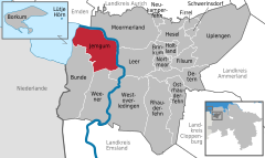
show Location of Jemgum within Leer district | |
 Jemgum | |
| Coordinates: 53°15′57″N 07°23′06″E / 53.26583°N 7.38500°ECoordinates: 53°15′57″N 07°23′06″E / 53.26583°N 7.38500°E | |
| Country | Germany |
| State | Lower Saxony |
| District | Leer |
| Government | |
| • Mayor | Hans-Peter Heikens (Ind.) |
| Area | |
| • Total | 78.48 km2 (30.30 sq mi) |
| Elevation | 0 m (0 ft) |
| Population (2020-12-31)[1] | |
| • Total | 3,595 |
| • Density | 46/km2 (120/sq mi) |
| Time zone | UTC+01:00 (CET) |
| • Summer (DST) | UTC+02:00 (CEST) |
| Postal codes | 26844 |
| Dialling codes | 0 49 58 |
| Vehicle registration | LER |
| Website | www.jemgum.de |


Jemgum is a municipality in the Leer district, in the northwest of Lower Saxony, Germany. The area is known as Rheiderland (German) or Reiderland (Dutch). Rheiderland is located in East Friesland. The East Friesland area of Germany (also known in English as East Frisia) is home to German writers Georg Klein (Bunde) and Uwe Kreisel (Jemgum).
History[]
Jemgum was the site of the Battle of Jemmingen on 21 July 1568, an early event of the Eighty Years' War, in which a Spanish army defeated a Dutch Rebel army under Louis of Nassau.
References[]
| show Towns and municipalities in Leer (district) |
|---|
| show Authority control |
|---|
This East Frisia article is a stub. You can help Wikipedia by . |
This Leer (district) location article is a stub. You can help Wikipedia by . |
Categories:
- Municipalities in Lower Saxony
- Populated places established in the 8th century
- Towns and villages in East Frisia
- Leer (district)
- Rheiderland
- East Frisia stubs
- Weser-Ems region geography stubs