Jeremy Ranch, Utah
Jeremy Ranch
Formerly known as Gorgoza | |
|---|---|
Community | |
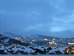 Jeremy Ranch on a winter evening in December 2006 | |
 Jeremy Ranch Location of Jeremy Ranch within the State of Utah | |
| Coordinates: 40°45′15″N 111°33′31″W / 40.75417°N 111.55861°WCoordinates: 40°45′15″N 111°33′31″W / 40.75417°N 111.55861°W | |
| Country | United States |
| State | Utah |
| County | Summit |
| Census-designated place | Summit Park |
| Elevation | 6,434 ft (1,961 m) |
| ZIP code | 84098 |
| GNIS feature ID | 1435770[1] |


Jeremy Ranch is a community within the Summit Park census-designated place in Summit County, Utah, United States.[1]
Description[]
The community is located in (at the head of ) on Interstate 80 about 9 miles (14 km) northwest of Park City and about 15 miles (24 km) east of Salt Lake City in an area previously known as Gorgoza.[2][3] East Canyon Creek flows northwest through the community and on through East Canyon.
The community has the well known Jeremy Ranch Golf Course, which was designed by Arnold Palmer.[4][5] The community sits at an elevation of 6,400 feet (2,000 m) in the Wasatch Range of the Rocky Mountains.[6] The Jeremy Ranch Elementary School (of the Park City School District) is located within the community.
References[]
- ^ a b c U.S. Geological Survey Geographic Names Information System: Jeremy Ranch
- ^ MyTopo Maps - Toll Canyon, Summit Park, UT, United States (Map). Trimble Navigation, Ltd. Retrieved 8 Jul 2016.
- ^ U.S. Geological Survey Geographic Names Information System: Gorgoza
- ^ "Jeremy Ranch Golf & Country Club". thejeremy.com. Retrieved 8 Jul 2016.
- ^ "Jeremy Ranch Golf and Country Club". utah.com. Retrieved 8 Jul 2016.
- ^ "Jeremy Ranch". placenames.com. Archived from the original on 15 February 2012. Retrieved 8 Jul 2016 – via web.archive.org.
External links[]
- Jeremy Ranch Golf & Country Club (official website)
- Jeremy Ranch Elementary School (official website)
This article about a location in Utah is a stub. You can help Wikipedia by . |
- Populated places in Summit County, Utah
- Utah geography stubs