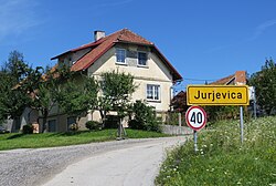
Jurjevica
Jurjevica | |
|---|---|
 | |
 Jurjevica Location in Slovenia | |
| Coordinates: 45°45′1.56″N 14°41′29.9″E / 45.7504333°N 14.691639°ECoordinates: 45°45′1.56″N 14°41′29.9″E / 45.7504333°N 14.691639°E | |
| Country | |
| Traditional region | Lower Carniola |
| Statistical region | Southeast Slovenia |
| Municipality | Ribnica |
| Area | |
| • Total | 1.74 km2 (0.67 sq mi) |
| Elevation | 542.1 m (1,778.5 ft) |
| Population (2002) | |
| • Total | 227 |
| [1] | |

Jurjevica (pronounced [ˈjuːɾjɛʋitsa]; German: Jurjowitz[2]) is a village west of the town of Ribnica in southern Slovenia. The area is part of the traditional region of Lower Carniola and is now included in the Southeast Slovenia Statistical Region.[3] The settlement includes the hamlet of Pajničev Mlin (German: Pajnitz'sche Mühlen[2]).[4]
The local church, built northeast of the village, is dedicated to the Holy Cross and belongs to the Parish of Ribnica. It dates to the 17th century. A series of fourteen roadside chapel-shrines with the Stations of the Cross lead to the church along the road from the neighbouring village of Breže.[5]
References[]
- ^ Statistical Office of the Republic of Slovenia
- ^ Jump up to: a b Leksikon občin kraljestev in dežel zastopanih v državnem zboru, vol. 6: Kranjsko. 1906. Vienna: C. Kr. Dvorna in Državna Tiskarna, pp. 48–49.
- ^ Ribnica municipal site
- ^ Weixelburg und Zirknitz (map, 1:75,000). 1912. Vienna: K.u.k. Militärgeographisches Institut.
- ^ Slovenian Ministry of Culture register of national heritage reference number ešd 28737
External links[]
 Media related to Jurjevica at Wikimedia Commons
- Jurjevica on Geopedia
| hide | ||
|---|---|---|
| Settlements | Administrative seat: Ribnica
|  |
| Landmarks |
| |
| Notable people | ||
This article about the Municipality of Ribnica in Slovenia is a stub. You can help Wikipedia by . |
Categories:
- Populated places in the Municipality of Ribnica
- Ribnica geography stubs