Kärkölä
Kärkölä | |
|---|---|
Municipality | |
| Kärkölän kunta Kärkölä kommun | |
 Kärkölä Church | |
 Coat of arms | |
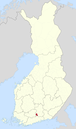 Location of Kärkölä in Finland | |
| Coordinates: 60°52′N 025°16.5′E / 60.867°N 25.2750°ECoordinates: 60°52′N 025°16.5′E / 60.867°N 25.2750°E | |
| Country | |
| Region | Päijänne Tavastia |
| Sub-region | Lahti sub-region |
| Charter | 1865 |
| Seat | Järvelä |
| Government | |
| • Mayor | Markku Koskinen |
| Area (2018-01-01)[1] | |
| • Total | 259.30 km2 (100.12 sq mi) |
| • Land | 256.47 km2 (99.02 sq mi) |
| • Water | 2.84 km2 (1.10 sq mi) |
| Area rank | 243rd largest in Finland |
| Population (2021-03-31)[2] | |
| • Total | 4,333 |
| • Rank | 187th largest in Finland |
| • Density | 16.89/km2 (43.7/sq mi) |
| Population by native language | |
| • Finnish | 96.9% (official) |
| • Swedish | 0.3% |
| • Others | 2.8% |
| Population by age | |
| • 0 to 14 | 13.3% |
| • 15 to 64 | 58.5% |
| • 65 or older | 28.1% |
| Time zone | UTC+02:00 (EET) |
| • Summer (DST) | UTC+03:00 (EEST) |
| Municipal tax rate[5] | 22% |
| Climate | Dfc |
| Website | www.karkola.fi |

Kärkölä (Finnish: [ˈkærkølæ]) is a municipality of Finland. It is located in the province of Southern Finland and is part of the Päijänne Tavastia region. The municipality has a population of 4,333 (31 March 2021)[2] and covers an area of 259.30 square kilometres (100.12 sq mi) of which 2.84 km2 (1.10 sq mi) is water.[1] The population density is 16.89 inhabitants per square kilometre (43.7/sq mi). Its seat is in Järvelä, which is located along the Riihimäki–Lahti railway.

Neighbour municipalities: Hausjärvi, Hollola, Hämeenlinna, Mäntsälä and Orimattila. The distance between Kärkölä and Lahti is 29 kilometres (18 mi).
The municipality is unilingually Finnish.
History[]
Kärkölä once belonged to the Hollola parish, and in 1711 it became the Hollola chapel parish. The first church was completed in 1754 and the second in 1889.[6] Officially, the municipality of Kärkölä was founded in 1867.[7] In the late 19th century, the eccentric engineer named Carl Constantin Collin, who ruled over large areas of both Hollola and Kärkölä, built large parks and building groups in the Huovila area.[8]
Villages[]
, , , , Järvelä, , Kärkölä (Kirkonkylä), Lappila, , , , ,
Notable people[]
- Carl Niclas von Hellens (1745–1820), botanist
- Erik Gabriel Melartin (1780–1847), the Archbishop of Turku
- Helvi Sipilä (1915–2009), diplomat, lawyer and politician
- Emil Väre (1885–1974), wrestler and Olympics gold medalist
See also[]
References[]
- ^ Jump up to: a b "Area of Finnish Municipalities 1.1.2018" (PDF). National Land Survey of Finland. Retrieved 30 January 2018.
- ^ Jump up to: a b "Preliminary population structure by area, 2021M01*-2021M03*". StatFin (in Finnish). Statistics Finland. Retrieved 2 May 2021.
- ^ "Population according to language and the number of foreigners and land area km2 by area as of 31 December 2008". Statistics Finland's PX-Web databases. Statistics Finland. Retrieved 29 March 2009.
- ^ "Population according to age (1-year) and sex by area and the regional division of each statistical reference year, 2003-2020". StatFin. Statistics Finland. Retrieved 2 May 2021.
- ^ "List of municipal and parish tax rates in 2021" (PDF). Tax Administration of Finland. 1 December 2020. Retrieved 10 April 2021.
- ^ "Kärkölän seurakunnan historia". Kärkölän kappeliseurakunta (in Finnish). Retrieved January 18, 2021.
- ^ "Kärkölän historiallisen perustamiskokouksen esityslista Kärkölän Huovilassa Tammikuun 26. päivänä 1867". Kärkölä (in Finnish). Retrieved January 18, 2021.
- ^ "Arvoituksellinen insinööri - Huovilan Collin". Kärkölä (in Finnish). Retrieved January 18, 2021.
External links[]
![]() Media related to Kärkölä at Wikimedia Commons
Media related to Kärkölä at Wikimedia Commons
- Municipality of Kärkölä – Official website (in Finnish)
| hide | ||
|---|---|---|
| Municipalities |  | |
| Former municipalities | ||
| Authority control |
|
|---|
- Kärkölä
- Populated places established in 1865