Kurshim
Kurshim | |
|---|---|
 Kurshim | |
| Coordinates: 48°34′20″N 83°39′15″E / 48.57222°N 83.65417°ECoordinates: 48°34′20″N 83°39′15″E / 48.57222°N 83.65417°E | |
| Country | |
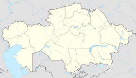
| Region | East Kazakhstan |
| District | Kurshim |
| Population (2009) | |
| • Total | 8,490 |
| Time zone | UTC+6 (+6) |

Kurshim, also Kurchum or Kurchim (Kazakh: Күршім) is a selo and administrative center of Kurshim District of East Kazakhstan Region, Kazakhstan. Population: 8,490 (2009 Census results);[1] 10,502 (1999 Census results).[1]
The Kurchum River flows past the town and Lake Zaysan lies to the south.[2][3] The town lies on the road between the villages of to the north-west and to the east; this road connects with the in the southeast which leads to Jeminay across the Chinese border in Xinjiang. The town is served by a small airport, , and Antonov An-2 biplanes fly in and out of the airport.[4] In late 1989 or early 1990 the town was affected by an earthquake which destroyed the Kurchum Hospital,[5] amongst other buildings. The landscape around the town is dominated by estuarine plains.
References[]
- ^ a b "Население Республики Казахстан" (in Russian). Департамент социальной и демографической статистики. Retrieved 8 December 2013.
- ^ Asociación Española de Ingeniería Sísmica; International Association for Earthquake Engineering (1992). Proceedings of the Tenth World Conference on Earthquake Engineering: 19–24 July 1992, Madrid, Spain. Taylor & Francis. p. 40. ISBN 978-90-5410-060-7. Retrieved 16 March 2012.
- ^ Maps (Map). Google Maps.
- ^ Brummell, Paul (24 October 2008). Bradt Kazakhstan. Bradt Travel Guides. p. 215. ISBN 978-1-84162-234-7. Retrieved 16 March 2012.
- ^ United States. Foreign Broadcast Information Service (1 January 1991). Daily Report: Soviet Union. The Service. p. 74. Retrieved 16 March 2012.
Capital: Oskemen | ||
| Districts | 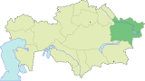 | |
| Major cities |
| |
This Kazakhstan location article is a stub. You can help Wikipedia by . |
- Populated places in East Kazakhstan Region
- Kazakhstan geography stubs