Kōjimachi
This article needs additional citations for verification. (February 2010) |
Kōjimachi
麹町 | |
|---|---|
District | |
 | |
| Coordinates: 35°41′4.01″N 139°45′29.79″E / 35.6844472°N 139.7582750°ECoordinates: 35°41′4.01″N 139°45′29.79″E / 35.6844472°N 139.7582750°E | |
| Country | Japan |
| City | Tokyo |
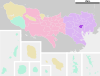
| Ward | Chiyoda |
| Area | Kōjimachi Area |
| Population (June 1, 2020) | |
| • Total | 2,719[1] |
| Time zone | UTC+9 (JST) |
| Area code(s) | 03 |

Kōjimachi (麹町 or 麴町) is a district in Chiyoda, Tokyo.
History[]
Prior to the arrival of Tokugawa Ieyasu, the area was known as Kōjimura (糀村). The area developed as townspeople settled along the Kōshū Kaidō.
In 1878, the Kōjimachi area became 麹町区 (Kojimachi-ku), a ward of the city of Tokyo. In 1934 and 1938, the addressing system along the Koshu-Kaido was reorganized, creating the 6 chomes subdivision for Kōjimachi that are still used.
In 1947, the Kōjimachi ward was merged with the Kanda ward to form the modern special ward Chiyoda, and the 6 chomes became the Kōjimachi district.
The area centered upon Kōjimachi including the districts of the Banchō area, Kioichō, Hirakawachō and Hayabusachō is sometimes referred as the Kōjimachi area (麹町地区), not to be mistaken with Kōjimachi ward (麹町区).
Landmarks and headquarters[]
- Embassy of Ireland
- Embassy of Belgium
- , handling the Asian business of Sunoco
- , a girl's junior and senior high school
- Nippon Flour Mills
- Nippon Television had its headquarters here, and maintains studios in the former headquarters building
- Nitto Boseki, a textile and fiberglass products company[2]
- The Japanese subsidiary of SAP
- Tokyo FM
- Tokyo MX
- Hanzōmon Station, Station Z-05 on the Tokyo Metro Hanzomon Line
- Kōjimachi Station, Station Y-15 on the Tokyo Metro Yurakucho Line
References[]
- ^ 千代田区区民生活部総合窓口課. "町丁別世帯数および人口(住民基本台帳):令和2年6月1日現在". Retrieved 2020-06-01.
- ^ "Company Profile." Nitto Boseki. Retrieved on February 27, 2015.
| show |
|---|
| Authority control |
|
|---|
- Neighborhoods of Tokyo
- Chiyoda, Tokyo