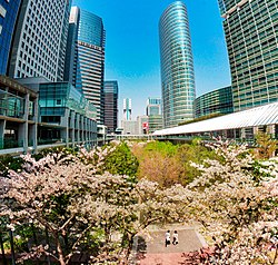
Kōnan, Tokyo
Kōnan
港南 | |
|---|---|
District | |
 | |
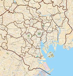 Kōnan Location of Kōnan within Tokyo | |
| Coordinates: 35°37′53.12″N 139°45′1.77″E / 35.6314222°N 139.7504917°E | |
| Country | Japan |
| Region | Kantō |
| Prefecture | Tokyo |
| Ward | Minato |
| Area | |
| • Total | 2.19 km2 (0.85 sq mi) |
| Population (August 1, 2019)[2] | |
| • Total | 20,819 |
| • Density | 9,500/km2 (25,000/sq mi) |
| Time zone | UTC+9 (JST) |
| Zip code | 108-0075 |
| Area code(s) | 03 |


Kōnan (港南) is a district of Minato, Tokyo, Japan. The current administrative place names are Konan 1-chome to Konan 5-chome. It is an area that belongs to the Shibaura-Kōnan District General Branch.
References[]
- ^ "平成27年国勢調査による各総合支所管内別の町丁目別面積・昼夜人口等". 港区. 2015-10-01. Retrieved 2019-09-08.
- ^ "各月1日現在の各総合支所管内別の町丁目別人口・世帯数(平成14年~平成31年・令和元年)". 港区. 2019-08-01. Retrieved 2019-09-08.
External links[]
| Wikimedia Commons has media related to Konan, Minato. |

| Authority control |
|
|---|
Categories:
- Districts of Minato, Tokyo