Kahama Urban District
Kahama Urban District | |
|---|---|
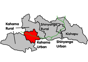 Kahama Urban's location within Shinyanga Region. Trunk roads in green. | |
| Coordinates: 03°50′S 032°35′E / 3.833°S 32.583°ECoordinates: 03°50′S 032°35′E / 3.833°S 32.583°E | |
| Country | |
| Region | Shinyanga Region |
| Population (2012) | |
| • Total | 242,208 |
| Website | official website |

Kahama Urban District is one of the five districts of the Shinyanga Region of Tanzania. Its administrative centre is the town of Kahama. It is bordered to the north and south by Kahama Rural District, to the east by Nzega District and to the west by Bukombe District.
According to the 2012 Tanzania National Census, the population of the Kahama Urban District was 242,208.[1]
Economy[]
Kahama is now an urban area, declared and publicly known. Its recent development, which are also fascinating, are the result of Isaka dry port and mining activities which have been going on for quite some time now. The town of Kahama now is enjoying the employment from Barrick Gold in the newly operating site of Buzwagi Gold Mine situated in between Kahama and Mwendakulima along Isaka road.
Also manufacturing activities are now part of the town which is already connected to new project of water from Lake Victoria which for decades was one of the problems the people of Kahama were facing. It has now grown to the extent it is connected with Nyihogo, Malunga, Shunu, nyahanga, Igomero nyakato, mbulu, Bukondamoyo, mhungulamwime, which made the urbanized area to grow also.
Transport[]
Road[]
Paved Trunk road T3 from Morogoro to the Rwanda border passes through Kahama Urban District from east to west.[2]
Wards[]
As of 2012, Kahama Urban District was administratively divided into 12 wards.[3]
- Busoka
- Isagehe
- Iyenze
- Kagongwa
- Kahama Mjini
- Kilago
- Kinaga
- Majengo
- Malunga
- Mhongolo
- Mhungula
- Mondo
- Mwendakulima
- Ngogwa
- Nyahanga
- Nyandekwa
- Nyasubi
- Nyihogo
- Wendele
- Zongomera
References[]
- ^ "Census 2012". National Bureau of Statistics. Archived from the original on 2016-03-05.
- ^ "Trunk and Regional Roads in Tanzania". Tanroads. Archived from the original on 8 December 2015. Retrieved 1 December 2015.
- ^ "2012 Census". National Bureau of Statistics. Archived from the original on 5 March 2016. Retrieved 1 December 2015.
- Districts of Shinyanga Region