Kaiser-Wilhelm-Koog
Kaiser-Wilhelm-Koog | |
|---|---|
 Coat of arms | |
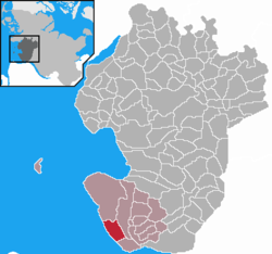
show Location of Kaiser-Wilhelm-Koog within Dithmarschen district | |
 Kaiser-Wilhelm-Koog | |
| Coordinates: 53°56′34″N 8°55′36″E / 53.94278°N 8.92667°ECoordinates: 53°56′34″N 8°55′36″E / 53.94278°N 8.92667°E | |
| Country | Germany |
| State | Schleswig-Holstein |
| District | Dithmarschen |
| Municipal assoc. | Marne-Nordsee |
| Government | |
| • Mayor | Ernst-Otto Wilkens |
| Area | |
| • Total | 13.06 km2 (5.04 sq mi) |
| Elevation | 0 m (0 ft) |
| Population (2020-12-31)[1] | |
| • Total | 365 |
| • Density | 28/km2 (72/sq mi) |
| Time zone | UTC+01:00 (CET) |
| • Summer (DST) | UTC+02:00 (CEST) |
| Postal codes | 25709 |
| Dialling codes | 04856 |
| Vehicle registration | HEI |
| Website | www.kaiser-wilhelm-koog.de |


Kaiser-Wilhelm-Koog is a municipality situated along the North Sea coast in the district of Dithmarschen, in Schleswig-Holstein, Germany.
The municipality is located in and named after the polder (German: Koog), which was finished in 1874 and named in honour of German Emperor William I. The Koog is entirely reclaimed land and therefore a completely flat area and is 0 meters above sea level.
References[]
| show Towns and municipalities of Dithmarschen |
|---|
| Authority control |
|---|
This Dithmarschen location article is a stub. You can help Wikipedia by . |
Categories:
- Municipalities in Schleswig-Holstein
- Dithmarschen
- Koogs
- Dithmarschen geography stubs