Kalabak
| Maja e Kallabakut | |
|---|---|
| Kalabak | |
 | |
| Highest point | |
| Elevation | 2,174 m (7,133 ft) |
| Coordinates | 41°55′04.8″N 20°34′33.6″E / 41.918000°N 20.576000°ECoordinates: 41°55′04.8″N 20°34′33.6″E / 41.918000°N 20.576000°E |
| Geography | |
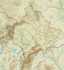 Maja e Kallabakut Location of Kalabak (on the Albanian-Kosovan border). | |
| Location | Kosovo[a] |
| Parent range | Šar Mountains |

Kalabak (Albanian: Maja e Kallabakut), also known as Halabak is a mountain belonging to the Šar Mountains, located in Albania and Kosovo[a]. Kalabak's height is 2,174 m (7,133 ft)[1][citation needed] above sea level and is located near the southern tip of Kosovo. Kalabak and its surroundings are treeless so it is an ideal places for shepherds to raise their sheep and the Šarplaninac as the protector.
Notes and references[]
Notes:
| a. | ^ Kosovo is the subject of a territorial dispute between the Republic of Kosovo and the Republic of Serbia. The Republic of Kosovo unilaterally declared independence on 17 February 2008. Serbia continues to claim it as part of its own sovereign territory. The two governments began to normalise relations in 2013, as part of the 2013 Brussels Agreement. Kosovo is currently recognized as an independent state by 97 out of the 193 United Nations member states. In total, 112 UN member states are said to have recognized Kosovo at some point, of which 15 later withdrew their recognition. |
References:
- ^ geo names lists it at 1946, but it is listed as 2174 in the wp
- ^ "NGA GEOnet Names Server". National Geospatial-Intelligence Agency. 2009-09-09. Archived from the original on 2003-10-08. Retrieved 2010-01-01.
This article about a specific location in Kukës County, Albania, is a stub. You can help Wikipedia by . |
This Kosovo location article is a stub. You can help Wikipedia by . |
Categories:
- Šar Mountains
- Two-thousanders of Albania
- Two-thousanders of Kosovo
- International mountains of Europe
- Albania–Kosovo border
- Geography of Kukës County
- Kukës County geography stubs
- Kosovo geography stubs