Kapiti Marine Reserve
| Kapiti Marine Reserve | |
|---|---|
 | |
| Location | New Zealand |
| Nearest city | Wellington |
| Coordinates | 40°52′52″S 174°56′56″E / 40.8811°S 174.9489°ECoordinates: 40°52′52″S 174°56′56″E / 40.8811°S 174.9489°E |
| Area | 21.67 km2 (8.37 sq mi) |
| Established | 1992 |
| Governing body | Department of Conservation |
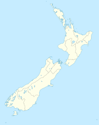
Kapiti Marine Reserve is a protected area on the west coast of the North Island of New Zealand. It lies between Paraparaumu and Waikanae beaches and Kapiti Island and is 30 kilometres north of the capital city Wellington.
It was created in 1992 and covers an area of 2,167 hectares (8.37 sq mi),[1] divided into an eastern and western section on either side of Kapiti Island.
See also[]
References[]
- ^ "Data Table - Protected Areas - LINZ Data Service (recorded area 2167 ha)". Land Information New Zealand. Retrieved 2019-08-29.
External links[]
- Kapiti Marine Reserve at the Department of Conservation
- Kapiti Marine Reserve fact sheet
- 2883511 Kapiti Marine Reserve on OpenStreetMap
Categories:
- Marine reserves of New Zealand
- Protected areas of the Wellington Region
- Protected areas established in 1992
- 1992 establishments in New Zealand
