Karakash River
This article does not cite any sources. (July 2007) |
| Karakash River | |
|---|---|
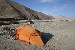 | |
 Location of the confluence with the Yurungkash River | |
| Location | |
| Country | China |
| Provinces | Aksai Chin, Xinjiang |
| Physical characteristics | |
| Source | Karakoram range |
| • location | Aksai Chin |
| • coordinates | 34°54′26″N 78°28′22″E / 34.907349°N 78.472665°E |
| • elevation | 19,000 feet (5,800 m) |
| Mouth | |
• location | Hotan River |
• coordinates | 38°05′09″N 80°33′41″E / 38.0858°N 80.5613°ECoordinates: 38°05′09″N 80°33′41″E / 38.0858°N 80.5613°E |
| Length | 740 km (460 mi) |
| Basin size | 19,983 km2 (7,715 sq mi) |
| Discharge | |
| • average | 69.7 m3/s (2,460 cu ft/s) |
| Basin features | |
| Progression | Hotan→ Tarim→ Taitema Lake |
| Landmarks | Xaidulla, Hotan |

The Karakash or Black Jade River, also spelled Karakax (Chinese: 喀拉喀什河; pinyin: Kālākāshí Hé, Uighur: قاراقاش دەرياسى, Қарақаш Дәряси), is a river in the Xinjiang autonomous region of the People's Republic of China that originates in the disputed Aksai Chin region administered by China. It passes through the historical settlement of Xaidulla (Shahidulla or Saitula) and passes by the city of Khotan (Hotan) to flow northeast in the Tarim Basin. It merges with the Yurungkash River, the combined river taking the name Hotan River and flowing into the Tarim River.
Course[]
The river begins above 19,000 feet (5,800 m) about 7 miles (11 km) northeast of Galwan Kangri peak in the disputed Aksai Chin region administered by China. It flows north to Sumnal (15,540 ft), then turns sharply eastwards, flowing at the foot of the Karatagh Range (skirting just north of the Soda Plains of Aksai Chin). Just beyond Palong Karpo, it reaches the foot of the Kunlun Mountains, where it turns sharply northwestwards, and crosses into Xinjiang proper. At this location it receives another headwater now called the 'East Karakash River' (which was once regarded as the main headwater). The combined river flows past the towns of Sumgal, Fotash, Gulbashem, until it reaches Xaidulla (Shahidulla).
The river then turns sharply northeastwards again near Xaidulla, and, after passing through Ali Nazar crosses the Kunlun mountain range near the Suget or Sanju Pass. It passes by east of Khotan, running parallel to the Yurungkash River, which it joins near (some 200 km north of Khotan, 38°05′N 80°34′E / 38.08°N 80.56°E). From there it continues north as the Hotan River, which flows into the Tarim River.
History[]
The Karakash River is famous for its white and greenish jade (nephrite) carried as river boulders and pebbles toward Khotan, as does the nearby Yurungkash (or 'White Jade') River. This river jade originates from eroded mountain deposits of which the most famous one is near Gulbashen, in southwestern Xinjiang (formerly Chinese Turkestan).
The Karakash Valley was also a caravan road for the north–south trade between Yarkand (China) and Leh over the Karakoram Pass in Leh District of Ladakh.
See also[]
- List of rivers in China
- Geography of Ladakh
External links[]
- Karakash River, OpenStreetMap, retrieved 6 August 2021.
- Tributaries of the Tarim
- Rivers of Xinjiang
- Geography of Ladakh
- Sites along the Silk Road
- Aksai Chin