Karima, Sudan
Karima | |
|---|---|
town | |
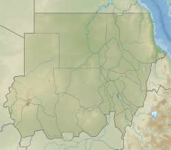 Karima Location in Sudan | |
| Coordinates: 18°33′N 31°51′E / 18.550°N 31.850°E | |
| Country | Sudan |
| Admin. division | Northern |
| Elevation | 255 m (837 ft) |
| Population (2012) | |
| • Total | 13,981 |

Karima is a town in Northern State in Sudan some 400 km from Khartoum on a loop of the Nile.
Karima houses the Jebel Barkal Museum. The hill of Jebel Barkal is near Karima. Beside it are the ruins of Napata, a city-state of ancient Nubia on the west bank of the Nile River, including the temples of Amun and Mut.
The Shaigiya tribe lived around Karima and Korti, but suffered for their support of the British against the Mahdi.
The land around Karima is a center for cultivation of Barakawi dates.
Karima is a terminus of a branch narrow gauge railway of the Sudan Railways system.
Halfway between Karima and El-Kurru there is an area with a large number of petrified trees.[1]
Climate[]
Karima has a hot desert climate (Köppen climate classification BWh).
| Climate data for Karima, Sudan (1961–1990) | |||||||||||||
|---|---|---|---|---|---|---|---|---|---|---|---|---|---|
| Month | Jan | Feb | Mar | Apr | May | Jun | Jul | Aug | Sep | Oct | Nov | Dec | Year |
| Record high °C (°F) | 37.3 (99.1) |
41.6 (106.9) |
45.5 (113.9) |
46.6 (115.9) |
48.0 (118.4) |
48.1 (118.6) |
47.5 (117.5) |
46.6 (115.9) |
46.6 (115.9) |
44.7 (112.5) |
40.8 (105.4) |
37.5 (99.5) |
48.1 (118.6) |
| Average high °C (°F) | 28.0 (82.4) |
30.5 (86.9) |
34.7 (94.5) |
38.8 (101.8) |
42.0 (107.6) |
43.4 (110.1) |
41.9 (107.4) |
41.4 (106.5) |
42.1 (107.8) |
39.2 (102.6) |
33.2 (91.8) |
29.4 (84.9) |
37.0 (98.6) |
| Daily mean °C (°F) | 19.1 (66.4) |
22.0 (71.6) |
26.0 (78.8) |
30.1 (86.2) |
33.5 (92.3) |
35.1 (95.2) |
34.5 (94.1) |
34.4 (93.9) |
34.6 (94.3) |
31.5 (88.7) |
25.6 (78.1) |
21.6 (70.9) |
29.0 (84.2) |
| Average low °C (°F) | 11.9 (53.4) |
13.5 (56.3) |
17.3 (63.1) |
21.5 (70.7) |
25.1 (77.2) |
26.9 (80.4) |
27.0 (80.6) |
27.1 (80.8) |
27.1 (80.8) |
23.8 (74.8) |
18.0 (64.4) |
13.8 (56.8) |
21.1 (70.0) |
| Record low °C (°F) | 3.6 (38.5) |
3.8 (38.8) |
7.5 (45.5) |
10.0 (50.0) |
16.7 (62.1) |
19.5 (67.1) |
20.7 (69.3) |
21.0 (69.8) |
19.0 (66.2) |
13.2 (55.8) |
7.7 (45.9) |
5.5 (41.9) |
3.6 (38.5) |
| Average precipitation mm (inches) | 0.0 (0.0) |
0.0 (0.0) |
0.0 (0.0) |
0.0 (0.0) |
0.1 (0.00) |
0.1 (0.00) |
7.7 (0.30) |
11.4 (0.45) |
1.1 (0.04) |
0.3 (0.01) |
0.0 (0.0) |
0.0 (0.0) |
20.7 (0.81) |
| Average precipitation days (≥ 0.1 mm) | 0.1 | 0.0 | 0.0 | 0.0 | 0.2 | 0.2 | 1.0 | 1.7 | 0.5 | 0.1 | 0.0 | 0.0 | 3.8 |
| Average relative humidity (%) | 30 | 23 | 19 | 17 | 16 | 17 | 24 | 29 | 22 | 23 | 29 | 33 | 23.5 |
| Mean monthly sunshine hours | 316.2 | 296.8 | 325.5 | 324.0 | 328.6 | 312.0 | 322.4 | 300.7 | 282.0 | 319.3 | 303.0 | 288.3 | 3,718.8 |
| Percent possible sunshine | 91 | 92 | 86 | 86 | 84 | 79 | 79 | 79 | 76 | 87 | 94 | 93 | 86 |
| Source: NOAA[2] | |||||||||||||
See also[]
References[]
- ^ Chunk of petrified wood near El Kurru (Northern Sudan) Retrieved 20 May 2019.
- ^ "Karima/Kuraymah Climate Normals 1961–1990". National Oceanic and Atmospheric Administration. Retrieved January 18, 2016.
Coordinates: 18°33′00″N 31°51′00″E / 18.55000°N 31.85000°E
This Sudan location article is a stub. You can help Wikipedia by . |
- Populated places in Northern (state)
- Populated places on the Nile
- Sudan geography stubs