Karlsfeld
Karlsfeld | |
|---|---|
 Ludl Chapel (1900) is one of the oldest still existing buildings in Karlsfeld | |
 Coat of arms | |
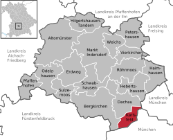
show Location of Karlsfeld within Dachau district | |
 Karlsfeld | |
| Coordinates: 48°13′N 11°28′E / 48.217°N 11.467°ECoordinates: 48°13′N 11°28′E / 48.217°N 11.467°E | |
| Country | Germany |
| State | Bavaria |
| Admin. region | Oberbayern |
| District | Dachau |
| Subdivisions | 4 Ortsteile |
| Government | |
| • Mayor (2020–26) | Stefan Kolbe[1] (CSU) |
| Area | |
| • Total | 15.55 km2 (6.00 sq mi) |
| Elevation | 491 m (1,611 ft) |
| Population (2020-12-31)[2] | |
| • Total | 21,813 |
| • Density | 1,400/km2 (3,600/sq mi) |
| Time zone | UTC+01:00 (CET) |
| • Summer (DST) | UTC+02:00 (CEST) |
| Postal codes | 85757 |
| Dialling codes | 08131 |
| Vehicle registration | DAH |
| Website | www.karlsfeld.de |


Karlsfeld is a municipality in the district of Dachau, in Bavaria, Germany. During World War II, it was the location of a subcamp of Dachau concentration camp.
The municipality is situated 12 km northwest of Munich (centre).
The headquarters of MAN and MTU Aero Engines are located in Munich right on the border to Karlsfeld.
Karlsfeld railway station is served by the Munich S-Bahn on line S2.
Twin town[]
- Muro Lucano, Italy
External links[]
- Karlsfeld Official web site
Notes[]
- ^ Liste der ersten Bürgermeister/Oberbürgermeister in kreisangehörigen Gemeinden, Bayerisches Landesamt für Statistik, accessed 19 July 2021.
- ^ "Tabellenblatt "Daten 2", Statistischer Bericht A1200C 202041 Einwohnerzahlen der Gemeinden, Kreise und Regierungsbezirke". Bayerisches Landesamt für Statistik (in German). June 2021.
| show Towns and municipalities in Dachau (district) |
|---|
| show Authority control |
|---|
This Dachau district location article is a stub. You can help Wikipedia by . |
Categories:
- Municipalities in Bavaria
- Dachau (district)
- Upper Bavaria geography stubs