Karula Upland
Karula Upland
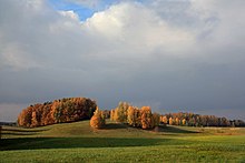
Karula Upland (Estonian: Karula kõrgustik) is hilly area of higher elevation in .[1]
Upland's area is about 350 km2.[1]
The highest point of upland is Tornimägi (137 m).[1]
References[]
- ^ a b c "Estonica.org - Karula kõrgustik". www.estonica.org (in Estonian). Retrieved 7 April 2020.
Coordinates: 57°42′52″N 26°29′12″E / 57.7144°N 26.4867°E

This Estonia location article is a stub. You can help Wikipedia by . |
Categories:
- Hills of Estonia
- Estonia geography stubs