Kasselaid
 | |
| Geography | |
|---|---|
| Location | Gulf of Riga |
| Coordinates | 58°8′33″N 22°32′33″E / 58.14250°N 22.54250°ECoordinates: 58°8′33″N 22°32′33″E / 58.14250°N 22.54250°E |
| Area | 49.92 ha (123.4 acres) |
| Coastline | 7.4 km (4.6 mi) |
| Administration | |
Estonia | |
| County | Saare County |
| Municipality | Lääne-Saare Parish |
| Settlement | Abruka village |
| Demographics | |
| Population | 0 |

Kasselaid is a 49.92 ha (123.4 acres)[1] uninhabited Estonian islet in the Gulf of Riga. It is located about 300 m (980 ft) east of the island of Abruka. Administratively Kasselaid belongs to the Abruka village in Lääne-Saare Parish, Saare County.
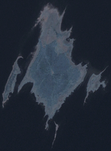
Kasselaid (right) on the satellite image with neighbouring islands.
See also[]
References[]
- ^ "Kasselaid" (in Estonian). EELIS – Estonian Nature Infosystem. Retrieved 24 May 2011.
This Saare County location article is a stub. You can help Wikipedia by . |
Categories:
- Uninhabited islands of Estonia
- Saaremaa Parish
- Estonian islands in the Baltic
- Saare County geography stubs