Kaur Regency
Kaur Regency
(Kabupaten Kaur) | |
|---|---|
 Coat of arms | |
 | |
| Country | Indonesia |
| Province | Bengkulu |
| Regency seat | |
| Area | |
| • Total | 2,365.00 km2 (913.13 sq mi) |
| Population (2020 Census)[1] | |
| • Total | 126,551 |
| • Density | 54/km2 (140/sq mi) |
| Time zone | UTC+7 (WIB) |
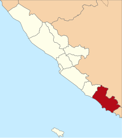
Kaur is the most southern regency of Bengkulu Province, Indonesia, on the island of Sumatra. It has an area of 2,365.00 km² and had a population of 107,899 at the 2020 Census[2] and 126,551 at the 2020 Census.[3] The regency seat is at the town of .
Administrative districts[]
The Regency is divided into fifteen districts (Indonesian: kecamatan), tabulated below with their areas and their populations at the 2010 Census[4] and the 2020 Census.[5] The table also includes the location of the district administrative centres, and the number of villages (totalling 192 rural desa and 3 urban kelurahan) in each district.
| Name | Area in km2 |
Pop'n Census 2010 |
Pop'n Census 2020 |
Admin centre |
No. of villages |
|---|---|---|---|---|---|
| Nasal | 519.92 | 15,166 | 16,600 | Merpas | 17 |
| Maje | 361.04 | 11,900 | 14,200 | Linau | 19 |
| Kaur Selatan (South Kaur) |
92.75 | 14,043 | 16,800 | Bintuhan | 19 * |
| Tetap | 87.92 | 5,859 | 6,900 | Tetap | 12 |
| Kaur Tengah (Central Kaur) |
26.40 | 4,365 | 5,100 | Tanjung Iman | 9 * |
| Luas | 124.88 | 4,822 | 5,600 | Benua Ratu | 12 |
| Muara Sahung | 256.00 | 5,445 | 6,700 | Ulak Lebar | 7 |
| Kinal | 154.03 | 4,268 | 4,800 | Tanjung Baru | 14 |
| Semidang Gumai | 64.91 | 5,398 | 6,500 | Mentiring | 13 |
| Tanjung Kemuning | 72.91 | 10,575 | 13,400 | Tanjung Kemuning | 20 |
| Kelam Tengah (Central Kelam) |
35.84 | 6,189 | 7,200 | Rigangan | 13 |
| Kaur Utara (North Kaur) |
49.80 | 6,422 | 7,600 | Simpang Tiga | 11 * |
| Padang Guci Hilir | 115.96 | 3,586 | 3,800 | Gunung Kaya | 9 |
| Lungkang Kule | 32.00 | 3,232 | 3,500 | Sukananti | 9 |
| Padang Guci Hulu | 370.64 | 6,629 | 7,800 | Bungin Tambun | 11 |
| Totals | 2,365.00 | 107,899 | 126,551 | Bintuhan | 195 |
Note: * the number of villages includes one urban kelurahan.
References[]
| show Authority control |
|---|
Coordinates: 4°35′21″S 103°25′00″E / 4.5893°S 103.4168°E

This Bengkulu location article is a stub. You can help Wikipedia by . |
- Regencies of Bengkulu
- Sumatra geography stubs