Kawatana, Nagasaki
This article does not cite any sources. (December 2008) |
Kawatana
川棚町 | |
|---|---|
Town | |
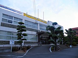 Kawatana Town Office | |
 Flag | |
 Location of Kawatana in Nagasaki Prefecture | |
 Kawatana Location in Japan | |
| Coordinates: 33°04′N 129°52′E / 33.067°N 129.867°ECoordinates: 33°04′N 129°52′E / 33.067°N 129.867°E | |
| Country | Japan |
| Region | Kyushu |
| Prefecture | Nagasaki Prefecture |
| District | Higashisonogi |
| Government | |
| • Mayor | Fumio Yamaguchi |
| Area | |
| • Total | 74.25 km2 (28.67 sq mi) |
| Population (January 1, 2009) | |
| • Total | 9,219 |
| • Density | 120/km2 (320/sq mi) |
| Time zone | UTC+09:00 (JST) |
| Website | kawatana |

Kawatana (川棚町, Kawatana-chō) is a town located in Higashisonogi District, Nagasaki Prefecture, Japan.
As of January 1, 2009, the town has an estimated population of 14,760 and a density of 396 persons per km2. The total area is 37.25 km2.
During World War II, manufacturing facilities associated with the Sasebo Naval Arsenal were constructed in Kawatana, leading to a temporary increase in population. The economy of the area is now heavily dependent on agriculture and fishing.
Geography[]
Surrounding municipalities[]
- Nagasaki Prefecture
- Sasebo
- Hasami
- Higashisonogi
- Saga Prefecture
Education[]
Kawatana have a prefectural high school, the Kawatana Prefectural High School (長崎県立川棚高等学校, Nagasaki-kenritsu Kawatana Kōtōgakkō), also known as Kawakō (川高). Meanwhile, the town also have a junior high school and three primary schools. There are also two special aid schools in Kawatana.
Transportation[]
Railway[]
- JR Kyushu
Highway[]
Japan National Route 205 passes through Kawatana.
External links[]
 Media related to Kawatana, Nagasaki at Wikimedia Commons
- Kawatana official website (in Japanese)
| show Authority control |
|---|
 | This Nagasaki Prefecture location article is a stub. You can help Wikipedia by . |
- Towns in Nagasaki Prefecture
- Nagasaki geography stubs