Kearsarge Pass
| Kearsarge Pass | |
|---|---|
 View west into the Sierra Nevada | |
| Elevation | 11,709 feet (3,569 m)[1] |
| Traversed by | Kearsarge Pass Trail[2] |
| Location | Fresno and Inyo counties, California, United States |
| Range | Sierra Nevada |
| Coordinates | 36°46′21″N 118°22′34″W / 36.7726017°N 118.3762477°WCoordinates: 36°46′21″N 118°22′34″W / 36.7726017°N 118.3762477°W[1] |

Kearsarge Pass is a pass in the Sierra Nevada of California. The pass lies on the Sierra Crest at 11,709 feet (3,569 m).[1] The pass permits foot traffic between Kings Canyon National Park and the John Muir Wilderness.[2]
The pass was named after the Kearsarge mine to the east, which was named by its owners after the USS Kearsarge, the ship that destroyed the CSS Alabama. The Alabama Hills were named after the latter ship, and the mine was named in reaction.[3] The first known crossing of Kearsarge Pass was in 1864.[3]
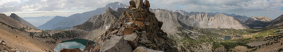
Panoramic from the pass

See also[]
References[]
| Wikimedia Commons has media related to Kearsarge Pass. |
- ^ Jump up to: a b c "Kearsarge Pass". Geographic Names Information System. United States Geological Survey.
- ^ Jump up to: a b "Kearsarge Pass Trail". Inyo National Forest. US Forest Service. Retrieved 2013-01-19.
- ^ Jump up to: a b Farquhar, Francis (1926). Place Names of the High Sierra. San Francisco: Sierra Club.
| Authority control |
|
|---|
Categories:
- Mountain passes of the Sierra Nevada (U.S.)
- Landforms of Fresno County, California
- Landforms of Inyo County, California
- Kings Canyon National Park