Kenton, Newcastle upon Tyne
This article includes a list of general references, but it remains largely unverified because it lacks sufficient corresponding inline citations. (January 2012) |
| Kenton | |
|---|---|
| Ward | |
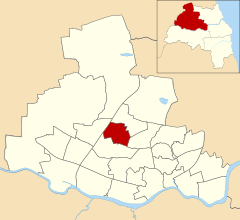 Kenton highlighted within Newcastle upon Tyne | |
 Kenton Location within Tyne and Wear | |
| OS grid reference | NZ225676 |
| Metropolitan borough | |
| Metropolitan county | |
| Ceremonial county | |
| Region | |
| Country | England |
| Sovereign state | United Kingdom |
| Post town | Newcastle upon Tyne |
| Postcode district | NE3 |
| Police | Northumbria |
| Fire | Tyne and Wear |
| Ambulance | North East |
| UK Parliament | |
| Councillors | Ged Bell (Labour) Anya Durrant (Labour) Stephen Lambert (Labour) |

Kenton is a suburb and electoral ward in the north west of Newcastle upon Tyne, England. It borders the Town Moor and Gosforth. Kenton also has close road links to Newcastle Airport. The ward population at the 2011 Census was 11,605.[1]
The area borders Kingston Park, notable for the Kingston Park shopping centre, as well as Kenton School, one of the largest schools in the UK with approximately 2000 students.
The nearest Tyne and Wear Metro station is Fawdon, with stations at Kingston Park and Bank Foot the other side of the A1 Western bypass. Nearby places include Fawdon and Cowgate.
Residential[]
Kenton contains a wide range of residential areas and developments. These residential areas range from Council housing estates to modern middle class new-builds and privately owned residential estates. In North Kenton and Kenton Bar, the housing is predominantly council owned. Kenton Lane, which runs through the heart of Kenton, contains traditional 1930s housing on both sides of the road, with more affluent households lining the streets behind.
Places of interest[]

Kenton contains a wide range of amenities and services for the local community, although some of these amenities are considered to be in Kingston Park and/or bordering Gosforth.
Kenton borders Kingston Park, home to the flagship Tesco Extra store, and has a smaller Tesco Express on Kenton Lane.
North Kenton hosts a shoppings centre locally known as Kenton Retail. The Shopping Centre dates back to 1950's as it was built with the grown demand of houses. The center is part of an ongoing renovation project that started late 2014, where it has been transformed into a refreshed centre. The centre includes a number of Stores such as Spar, Boots, Premier Local, Post Office, Greggs and Subway. It also includes a Male Barber Shops and Female Salon and a number of different takeaways.
The shopping centre shares a car park with the Kenton Centre. The Kenton Centre is located on Hillsview Avenue also includes a GP surgery,[2] library, housing office[3] and a social services team.
Kenton Dene is a large green space between Kenton, Montague and Cowgate that exists to the side of Kenton Lane. It has been host to many local events and festivals and is a popular area for dog walkers and walkers alike. Kenton Riding School is situated next to Kenton Dene. The dene also leads onto part of the Newcastle Moor.[4]
Popular pubs in Kenton include the Duke of Wellington and Kenton Social Club
History[]
Possibly the first Kenton streets, Shiney Row & Low Row,[5] were built for Kenton Colliery which was situated in what is now Montagu Estate.[6][7] The colliery was the supply point for Kitty's Drift, a 3-mile underground railway tunnel used for transporting coal to the Bells Close staiths on the Tyne near Scotswood.[8]
Local representation[]
Kenton is currently represented locally by 3 Labour City Councillors, including Ged Bell, Stephen Lambert and Anya Durrant. Nationally, Kenton is incorporated into the Newcastle upon Tyne Central constituency which is represented by Chi Onwurah.
Schools[]
Kenton has four primary schools, as follows.
- Mountfield Primary[9]
- St Cuthbert's Roman Catholic Primary[10]
- Wyndham Primary[11]
- Kenton Bar Primary
Secondary education and Sixth Form is provided by Kenton School.
References[]
- ^ "Ward population 2011". Retrieved 5 July 2015.
- ^ "Overview - Kenton Medical Centre (Betts Avenue Medical Centre) - NHS".
- ^ "Kenton Library | Newcastle City Council".
- ^ "Kenton Dene".
- ^ "OS Map 1894-98".
- ^ "Kenton Colliery - Sitelines". 26 May 2021.
- ^ "Kenton Colliery-DMM.org".
- ^ "Kitty's Drift - Sitelines". 26 May 2021.
- ^ "Our School | Mountfield Primary School".
- ^ "Welcome to St Cuthbert's Catholic Primary School".
- ^ "Wyndham Primary School - GOV.UK".
External links[]
- Districts of Newcastle upon Tyne
- Wards of Newcastle upon Tyne