Khangai Mountains
| Khangai | |
|---|---|
 Panorama of Lake Terkhiin Tsagaan in the Khangai Mountains | |
| Highest point | |
| Peak | Otgontenger |
| Elevation | 4,031 m (13,225 ft) |
| Naming | |
| Native name | Хангай |
| Geography | |
 | |
| Countries | Mongolia |
| Aimags | Arkhangai, Övörkhangai, Bayankhongor and Zavkhan |
| Rivers | Ider River and Orkhon River |
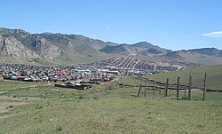
| Settlements | Tsetserleg, Bayankhongor and Uliastai |
| Range coordinates | 47°30′N 100°0′E / 47.500°N 100.000°ECoordinates: 47°30′N 100°0′E / 47.500°N 100.000°E |

The Khangai Mountains (Mongolian: Хангайн нуруу, romanized: Hangain nuruu); form a range in central Mongolia,[1] some 400 km (250 mi) west of Ulaanbaatar.
Name[]
This section does not cite any sources. (December 2014) |
Two provinces of Mongolia are named after the Khangai mountains: Arkhangai (Northern Khangai) and Ovorkhangai (Southern Khangai). The mild climate area where the two provinces meet (eastern Khangai) is known as the cradle of Mongolian and nomadic civilization. The plains at the foot of the eastern Khangai host the Orkhon Valley World Heritage Site. The Xiongnu (209BC - 93AD) capital Luut Khot (Lungcheng), the Xianbei (93AD -234 AD) capital Ordo and the Rouran (330-555) capital Moomt (Mume) are said to have been located there. Later empires also established their capitals there, for example the Uyghur Empire (745-840) built their capital Ordu-Baliq in the region.
Features[]

The tallest mountain is Otgontenger (lit. "youngest sky"), the height of which is given as 3,905, 4,021, and 4,031 m depending on the source. It is one of the four paramount sacred mountains of Mongolia. State ceremonies are held there.
Suvraga Khairkhan (Stupa Khairkhan, height 3,117m) is another sacred mountain to the east of Tsetserleg.
Taryatu-Chulutu is an extinct volcanic field on the northern slopes of the Khangai Mountains.
The mountains feed the rivers Orkhon, Selenge, Ider, Zavkhan and the lakes Orog and Böön tsagaan. In the west the Khangai mountains transition into the Great Lakes Depression.
The Khangai mountain region is known for its mild microclimates in certain areas. Winters there are not as harsh as in other parts of the country. As noted in Brzezniak and Niedzwiedz's "Vertical Variability of Climatic Conditions in the Khangai Mountains" p. 34:[2]
Because of strong winter inversions which have become known as a singularity of the mesoclimate of Mongolia (Gavrilova 1974) the Khangai tends to be some 10°C warmer than the surrounding areas. It is likely that even the highest mountain tops are some 5°C warmer than the sub-Khangai basins.

References[]
- ^ McDannell, Kalin T.; Zeitler, Peter K.; Idleman, Bruce D. (2018-07-21). "Relict topography within the Hangay Mountains in central Mongolia: Quantifying long-term exhumation and relief change in an old landscape". Tectonics. 37 (8): 2531–2558. doi:10.1029/2017TC004682. ISSN 0278-7407.
- ^ # Eligiusz Brzezniak, Tadeusz Niedzwiedz, Vertical Variability of Climatic Conditions in the Khangai Mountains, 1980.
| hide Authority control | |
|---|---|
| General | |
| National libraries | |
| Other | |
- Mountain ranges of Mongolia