Khomuli Cave Natural Monument
| Khomuli Cave Natural Monument | |
|---|---|
 Inside Khomuli Cave | |
 | |
| Nearest city | Tsqaltubo |
| Coordinates | 42°18′53.3″N 42°38′07.0″E / 42.314806°N 42.635278°ECoordinates: 42°18′53.3″N 42°38′07.0″E / 42.314806°N 42.635278°E |
| Area | 0.01 km2 (0.0039 sq mi) |
| Established | 2007 |
| Governing body | Agency of Protected Areas |
| Website | ხომულის მღვიმის ბუნების ძეგლი |
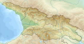
Khomuli Cave Natural Monument (Georgian: ხომულის მღვიმე) is a karst cave located 3.7 km to the south from village Khomuli, Tsqaltubo Municipality in Imereti region of Georgia, 160 meters above sea level.[1]
Morphology[]
Khomuli karst cave was formed in limestones. Total length - 4 meters. In the front of the cave entrance, on the surface, there is an oval-shaped lake, 5 meters deep and 30 meters in circumference. Through the underground waterways lake is connected to the Tsqaltubo water reservoir (Tsivi Lake). At the cave entrance there is a raised cornice. Cave is divided into two parts. The main part is rather extensive with numerous karst formations, some looks like footprints. The other part is a narrow tunnel, which can be accessed only with special equipment. At the bottom of the tunnel there is a small lake.[2]
See also[]
References[]
| Wikimedia Commons has media related to Khomuli Cave Natural Monument. |
- ^ Khomuli Karst Cave in Georgia Protected Planet
- ^ (in Georgian) ხომულის მღვიმის ბუნების ძეგლი
- IUCN Category III
- Natural monuments of Georgia (country)
- Caves of Georgia (country)
- Protected areas established in 2011
- Geography of Imereti
- Georgia (country) geography stubs

