Kita-ku, Kyoto
This article needs additional citations for verification. (November 2015) |
Kita
北区 | |
|---|---|
Ward of Kyoto | |
 Kinkaku, the Golden Pavilion of Rokuon-ji, is one of the most famous landmarks of Kita-ku. | |
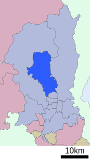 Location of Kita-ku in Kyoto | |
 Kita Location of Kita-ku in Japan | |
| Coordinates: 35°2′28″N 135°45′15″E / 35.04111°N 135.75417°ECoordinates: 35°2′28″N 135°45′15″E / 35.04111°N 135.75417°E | |
| Founded | 1955 |
| Area | |
| • Total | 94.88 km2 (36.63 sq mi) |
| Highest elevation | 895 m (2,936 ft) |
| Lowest elevation | 60 m (200 ft) |
| Population (October 1, 2015) | |
| • Total | 119,474 |
| • Density | 1,300/km2 (3,300/sq mi) |
| Time zone | UTC+9 (Japan Standard Time) |
| Website | www |

Kita (北区, Kita-ku) is one of the eleven wards in the city of Kyoto, in Kyoto Prefecture, Japan. Its name means "North Ward." As of 2016, the ward has an estimated population of 119,074 people.[1]
Demographics[]
| Year | Pop. | ±% |
|---|---|---|
| 1960 | 123,230 | — |
| 1970 | 135,681 | +10.1% |
| 1980 | 136,181 | +0.4% |
| 1990 | 127,348 | −6.5% |
| 2000 | 126,125 | −1.0% |
| 2010 | 122,037 | −3.2% |
| 2015 | 119,474 | −2.1% |
| Source: [1] | ||
Education[]
Universities[]
- Bukkyo University
- Kyoto Sangyo University
- Ritsumeikan University, Kinugasa Campus
- Otani University
Primary and secondary schools[]
This section needs expansion. You can help by . (October 2015) |
The community previously had a North Korean school, Kyoto Korean No. 3 Elementary School (京都朝鮮第三初級学校).[2]
Culture[]
Temples and Landmarks[]
- Daitoku-ji a famous Rinzai sect temple.
- Kamigamo Shrine, one of the oldest shrines in Japan.
- Kinkaku-ji, the Golden Pavilion, one of Japan's most famous temples.
- Imamiya Shrine, an ancient Shinto shrine dedicated to healing.
References[]
External links[]
| Wikivoyage has a travel guide for North Kyoto. |
![]() Media related to Kita-ku, Kyoto at Wikimedia Commons
Media related to Kita-ku, Kyoto at Wikimedia Commons
- Official website (in Japanese)
| show Authority control |
|---|
This Kyoto Prefecture location article is a stub. You can help Wikipedia by . |
Categories:
- Wards of Kyoto
- Kyoto geography stubs