Kitaurakohan Station
This article needs additional citations for verification. (October 2020) |
Kitaurakohan Station 北浦湖畔駅 | |
|---|---|
 Kitaurakohan Station, March 2008 | |
| Location | Kajimayama 1423-3, Hokota-shi, Ibaraki-ken 311-2104 Japan |
| Coordinates | 36°07′14″N 140°32′12″E / 36.1206°N 140.5368°ECoordinates: 36°07′14″N 140°32′12″E / 36.1206°N 140.5368°E |
| Operated by | |
| Line(s) | ■ Ōarai-Kashima Line |
| Distance | 34.9 km from Mito |
| Platforms | 1 side platform |
| Connections |
|
| Other information | |
| Status | Unstaffed |
| Website | Official website |
| History | |
| Opened | 14 March 1985 |
| Passengers | |
| FY2015 | 42 daily |
| Location | |
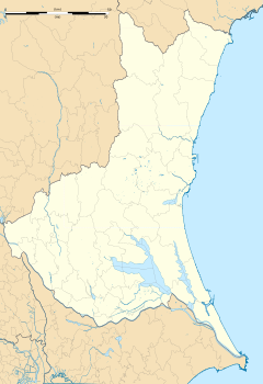 Kitaurakohan Station Location within Ibaraki Prefecture | |


Kitaurakohan Station (北浦湖畔駅, Kitaurakohan-eki) is a passenger railway station in the town of Hokota, Ibaraki Prefecture, Japan operated by the third sector Kashima Rinkai Railway.
Lines[]
Kitaurakohan Station is served by the Kashima Rinkai Railway’s Ōarai Kashima Line, and is located 34.9 km from the official starting point of the line at Mito Station.
Station layout[]
The station consists of a single side platform built on an embankment. The platform serves traffic in both directions. There is no station building, and the station is unattended.
Adjacent stations[]
| « | Service | » | ||
|---|---|---|---|---|
| Ōarai Kashima Line | ||||
| Shin-Hokota | - | Taiyō | ||
History[]
Kitaurakohan Station was opened on 14 March 1985 with the opening of the Ōarai Kashima Line.
Passenger statistics[]
In fiscal 2015, the station was used by an average of 42 passengers daily. [1]
Surrounding area[]
- Kitaura
- Cabinet Satellite Intelligence Center
See also[]
References[]
- ^ 国土数値情報(駅別乗降客数データ) - 国土交通省、July 3, 2019
External links[]
![]() Media related to Kitaura-Kohan Station at Wikimedia Commons
Media related to Kitaura-Kohan Station at Wikimedia Commons
- Kashima Rinkai Testudo Station Information (in Japanese)
This Ibaraki Prefecture railroad station-related article is a stub. You can help Wikipedia by . |
- Railway stations in Ibaraki Prefecture
- Stations of Kashima Rinkai Railway
- Railway stations in Japan opened in 1985
- Hokota, Ibaraki
- Ibaraki Prefecture railway station stubs