Kožuf
| Kožuf | |
|---|---|
| Tzena, Zona | |
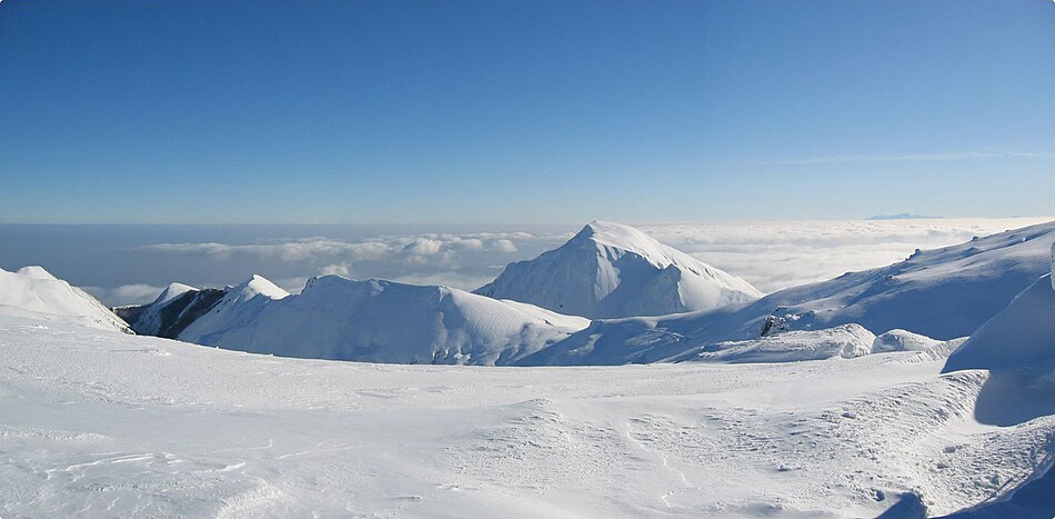
 Panorama of Kožuf | |
| Highest point | |
| Elevation | 2,171 m (7,123 ft) |
| Coordinates | 41°13′00″N 22°10′00″E / 41.21667°N 22.16667°ECoordinates: 41°13′00″N 22°10′00″E / 41.21667°N 22.16667°E |
| Geography | |
 Kožuf North Macedonia | |
| Location | Border between North Macedonia and Greece |

Kožuf mountain or Tzena / Zona (Greek: Τζένα/Tzena, Ζώνα/Zona, Macedonian: ![]() Кожуф планина (help·info)) is a mountain situated in the southern part of North Macedonia and northern part of Greece. Associated village names are Konopishte, Kavadarci and Gevgelija. is a mineral springwater site on its northeastern flank.[1] Kavadarci Municipality and Gevgelija Municipality split the mountain.
Кожуф планина (help·info)) is a mountain situated in the southern part of North Macedonia and northern part of Greece. Associated village names are Konopishte, Kavadarci and Gevgelija. is a mineral springwater site on its northeastern flank.[1] Kavadarci Municipality and Gevgelija Municipality split the mountain.
Its most western parts reach the river Blashnica, and the north-western side stretches in a line, from the Mrezhichko village via the village of Konopishte, through the course of Boshava to the city of Demir Kapija. Kozuf is a specific mountain because it is the first natural barrier in North Macedonia that is directly exposed to the influences of the Mediterranean and the Aegean Sea. Its highest peak is Zelen Breg (or Portes), at 2,171 meters above the sea level.
A new and modern ski center, whose construction began in 2001,[1] was opened in 2009 on the mountain.[2]
Photo[]
External links[]
| Wikimedia Commons has media related to Kožuf. |
References[]
- ^ Jump up to: a b "Kozuf - untouched ecological nature". North Macedonia Timeless.
- ^ Kožuf ski resort
This Central Macedonia location article is a stub. You can help Wikipedia by . |
This North Macedonia location article is a stub. You can help Wikipedia by . |
This article related to a mountain, mountain range, or peak in Greece is a stub. You can help Wikipedia by . |
- Ski areas and resorts in North Macedonia
- Greece–North Macedonia border
- Two-thousanders of Greece
- Two-thousanders of North Macedonia
- Central Macedonia geography stubs
- North Macedonia geography stubs
- Greece geography stubs
- Europe mountain stubs