Kokonoe, Ōita
Kokonoe
九重町 | |
|---|---|
Town | |
 Flag  Chapter | |
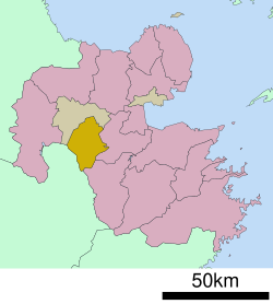 Location of Kokonoe in Ōita Prefecture | |
 Kokonoe Location in Japan | |
| Coordinates: 33°14′N 131°11′E / 33.233°N 131.183°ECoordinates: 33°14′N 131°11′E / 33.233°N 131.183°E | |
| Country | Japan |
| Region | Kyushu |
| Prefecture | Ōita Prefecture |
| District | Kusu |
| Area | |
| • Total | 271.37 km2 (104.78 sq mi) |
| Population (March 31, 2017) | |
| • Total | 9,804 |
| • Density | 36/km2 (94/sq mi) |
| Time zone | UTC+09:00 (JST) |
| Website | www |

Kokonoe (九重町, Kokonoe-machi) is a small town located in Kusu District, Ōita Prefecture, Japan. It promotes its nine onsen, which are occasionally closed due to flooding; it is also the summer headquarters of Labo Camp Kujū, part of the language program.
Kokonoe consists mainly of farms, hot springs, and countryside tourist attractions.
As of March 2017, the town has an estimated population of 9,804 and the density of 36 persons per km².[1] The total area is 271.37 km².
Geography[]
Kokonoe is located within the western part of Oita, with most of the area is covered within the Aso Kujū National Park. Mount Kujū is located here with the Kusu River flowing through Kokonoe.
Neighbouring municipalities[]
- Ōita Prefecture
- Kumamoto Prefecture
Transportation[]
Railway[]
- JR Kyushu
- Kyūdai Main Line: Era - Hikiji - Bungo Nakamura - Noya
Highways[]
- Ōita Expressway
- Japan National Routes
Relations[]
Kokonoe have a sister city relationship with the city of Sasebo in Nagasaki since 26 July 1991.
Gallery[]
 Naruhodo Hot Spring in Kokonoe, not one of the promoted nine |
 The Kokonoe Yume (Dream) Suspension Bridge |
References[]
- ^ "Official website of Kokonoe city" (in Japanese). Japan: Kokonoe City. Retrieved 22 April 2017.
External links[]
 Media related to Kokonoe, Ōita at Wikimedia Commons
- Kokonoe official website (in Japanese)
| show Authority control |
|---|
This Ōita Prefecture location article is a stub. You can help Wikipedia by . |
- Towns in Ōita Prefecture
- Ōita geography stubs