Kolkhida (daba)
It has been suggested that this article be merged with Psakhara. (Discuss) Proposed since October 2021. |
This article needs additional citations for verification. (April 2016) |
Kolkhida
Ԥсахара (in Abkhazian) კოლხიდა (in Georgian) | |
|---|---|
Village | |
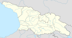 Kolkhida Location in Georgia | |
| Coordinates: 43°14′00″N 40°18′00″E / 43.23333°N 40.30000°ECoordinates: 43°14′00″N 40°18′00″E / 43.23333°N 40.30000°E | |
| Country | Georgia |
| District | Gagra |
| Community | Kolkhida (center) |
| Elevation | 20 m (70 ft) |
| Population (1989) | |
| • Total | 3 102[1] |
| Time zone | UTC+4 (GET) |

Kolkhida (Abkhazian: Ԥсахара, Phsachara, Georgian: კოლხიდა, Kʼolkhida) is a daba and a community center at an altitude of 20 meters from sea level in the Gagra District of Abkhazia,[note 1] Georgia. Official status of urban-type settlement was received in 1982.
See also[]
Notes[]
- ^ Abkhazia is the subject of a territorial dispute between the Republic of Abkhazia and Georgia. The Republic of Abkhazia unilaterally declared independence on 23 July 1992, but Georgia continues to claim it as part of its own sovereign territory and designates it as a territory occupied by Russia. Abkhazia has received formal recognition as an independent state from 7 out of 193 United Nations member states, 1 of which has subsequently withdrawn its recognition.
Literature[]
References[]
- ^ "All-USSR census 1989 in Abkhazian ASSR". pop-stat.mashke.org. Retrieved 2016-08-01.
| Municipalities |
| ||||||
|---|---|---|---|---|---|---|---|
| Other populated places |
| ||||||
This Georgia location article is a stub. You can help Wikipedia by . |
Categories:
- Populated places in Gagra District
- Georgia (country) geography stubs