Kollam district
This article possibly contains original research. (October 2017) |
Kollam District
Quilon District | |
|---|---|
District | |
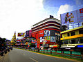
 From top: Paravur estuary, Light house and clock tower in Kollam city, 13 Ring bridge of Thenmala, Check dam across Kallada river | |
| Nickname(s): Cashew capital of the world | |
Location in Kerala | |
| Coordinates: 8°48′N 76°36′E / 8.8°N 76.6°ECoordinates: 8°48′N 76°36′E / 8.8°N 76.6°E | |
| Country | India |
| State | Kerala |
| Headquarters | Kollam |
| Government | |
| • Collector | B. Abdul Nasar |
| • City Police Commissioner | Narayanan T IPS |
| • Rural Superintendent of Police | Harisankar IPS |
| Area | |
| • Total | 2,491 km2 (962 sq mi) |
| Area rank | 6th |
| Population (2011) | |
| • Total | 2,635,375 |
| • Density | 1,100/km2 (2,700/sq mi) |
| Languages | |
| • Official | Malayalam, English |
| Time zone | UTC+5:30 (IST) |
| Vehicle registration |
|
| HDI (2005) | |
| Sex ratio | 1113 ♂/♀ |
| Literacy | 93.77%[1] |
| Website | www |


Kollam district (formerly Quilon) is one of 14 districts of the state of Kerala, India. The district has a cross-section of Kerala's natural attributes; it is endowed with a long coastline, a major Laccadive Sea seaport and an inland lake (Ashtamudi Lake). The district has many water bodies. Kallada River is one among them, and the east side land of river is East Kallada and the west side land is West Kallada.
Overview[]
Kallada Boat race is one of the famous festival events of the district. Even though it is a competition between two land sides of the river, many boat clubs from various places, even beyond the district participate in the event. Kollam is the capital of Kerala's cashew industry. Plains, mountains, lakes, lagoons, and backwaters, forests, farmland and rivers make up the topography of the district. The area had trading relationships with Phoenicia and Ancient Rome.
Climate[]
| Kollam | ||||||||||||||||||||||||||||||||||||||||||||||||||||||||||||
|---|---|---|---|---|---|---|---|---|---|---|---|---|---|---|---|---|---|---|---|---|---|---|---|---|---|---|---|---|---|---|---|---|---|---|---|---|---|---|---|---|---|---|---|---|---|---|---|---|---|---|---|---|---|---|---|---|---|---|---|---|
| Climate chart (explanation) | ||||||||||||||||||||||||||||||||||||||||||||||||||||||||||||
| ||||||||||||||||||||||||||||||||||||||||||||||||||||||||||||
| ||||||||||||||||||||||||||||||||||||||||||||||||||||||||||||
Kollam's temperature is almost steady throughout the year. The average temperature ranges from 25 to 32 degrees Celsius. Summer usually runs from March until May; the monsoon begins by June and ends by September. Kollam receives an annual average rainfall of around 2,700 millimetres (110 in).
It receives both southwest and northeast monsoons. Winter is from November to February; the temperature is moderately cool, ranging from 18 to 25 degrees Celsius.[3]
| hideClimate data for Kollam (Quilon)[3] | |||||||||||||
|---|---|---|---|---|---|---|---|---|---|---|---|---|---|
| Month | Jan | Feb | Mar | Apr | May | Jun | Jul | Aug | Sep | Oct | Nov | Dec | Year |
| Average high °C (°F) | 32 (90) |
33 (91) |
33 (91) |
33 (91) |
33 (91) |
30 (86) |
30 (86) |
30 (86) |
31 (88) |
31 (88) |
31 (88) |
32 (90) |
33 (91) |
| Average low °C (°F) | 22 (72) |
23 (73) |
24 (75) |
25 (77) |
25 (77) |
24 (75) |
23 (73) |
23 (73) |
24 (75) |
24 (75) |
23 (73) |
23 (73) |
22 (72) |
| Average precipitation mm (inches) | 24.4 (0.96) |
30.9 (1.22) |
77.7 (3.06) |
159.5 (6.28) |
246.9 (9.72) |
458.8 (18.06) |
408.9 (16.10) |
258.9 (10.19) |
211.2 (8.31) |
332.5 (13.09) |
230.8 (9.09) |
65.4 (2.57) |
2,700 (106.30) |
| Source 1: [4] | |||||||||||||
| Source 2: [5] | |||||||||||||
Demographics[]
| Year | Pop. | ±% p.a. |
|---|---|---|
| 1901 | 406,013 | — |
| 1911 | 465,684 | +1.38% |
| 1921 | 552,333 | +1.72% |
| 1931 | 698,041 | +2.37% |
| 1941 | 856,585 | +2.07% |
| 1951 | 1,110,362 | +2.63% |
| 1961 | 1,461,103 | +2.78% |
| 1971 | 1,839,265 | +2.33% |
| 1981 | 2,175,339 | +1.69% |
| 1991 | 2,407,566 | +1.02% |
| 2001 | 2,585,208 | +0.71% |
| 2011 | 2,635,375 | +0.19% |
| source:[6] | ||
According to the 2011 census Kollam district has a population of 2,635,375,[7] roughly equal to the nation of Kuwait[8] or the US state of Nevada.[9] This gives it a ranking of 155th in India (out of a total of 640 districts).[7] The district has a population density of 1,056 inhabitants per square kilometre (2,740/sq mi) .[7] Its population growth rate over the decade 2001-2011 was 1.72 percent.[7] Kollam has a sex ratio of 1113 females for every 1000 males. The total literacy rate of Kollam district was 94.09%. The male literacy rate was 96.09% and the female literacy rate was 92.31% in Kollam district.[7]
Urban structure[]
The Kollam Urban Agglomeration (UA) is the 6th most populous UA in the state. Kollam is placed 49th in the list of most populous urban agglomerations in India. The total urban population of the entire district is 1,187,158.[1] The metropolitan area of Kollam includes Adichanalloor, Adinad, Ayanivelikulangara, Chavara, Elampalloor, Eravipuram (part), Karunagappally, Kollam, Valakom, Kundara, Kulasekharapuram, Mayyanad, Meenad, Nedumpana, Neendakara, Oachira, Panayam, Panmana, Paravur, Perinad, Poothakkulam, Thazhuthala, Thodiyoor, Thrikkadavoor, Thrikkaruva, Thrikkovilvattom, and Vadakkumthala.[10]
Religion[]

Hinduism (64.42%) is practised by majority of the people in Kollam district of which Nair (32%) and Ezhava (30.5%) are the largest sub groups. Islam(19.3%) is the second largest religion. Kollam is the only district in Southern Kerala where Muslims outnumber Christians. Despite this Kollam has a significant Christian population too (16%) among this the Latin Catholics (36.7%) and Malankara Orthodox Syrian Church Christians (34.24%) form the majority. The Marthoma Church from 19.06% of the Christians in the district.
Major cities & towns[]
| Rank | Pop. | ||||||||
|---|---|---|---|---|---|---|---|---|---|
 Kollam*  Punalur |
1 | Kollam* | Kollam | 406,392 |  Chavara  Mayyanad | ||||
| 2 | Punalur | 46,702 | |||||||
| 3 | Chavara | 42,655 | |||||||
| 4 | Mayyanad | Kollam | 40,039 | ||||||
| 5 | Paravur | Kollam | 37,245 | ||||||
| 6 | Kundara | Kollam | 33,959 | ||||||
| 7 | Kottarakkara | 29,788 | |||||||
| 8 | Ochira | 28,412 | |||||||
| 9 | Karunagappally | 25,336 | |||||||
| 10 | Chathannoor | Kollam | 28,029 | ||||||
*In 2015, the area of Kollam City Corporation increased by merging Thrikkadavoor panchayath.
Administration[]

The history of the district's administration can be traced back to 1835, when the Travancore state consisted of two revenue divisions with headquarters at Kollam and Kottayam. When Travancore and Cochin were combined into Travancore-Cochin, Kollam was one of the three revenue divisions. When the state of Kerala was formed in 1957, half portion of Chenkotta taluk was merged with the state of Madras. Later in 1957, the Cherthala, Ambalapuzha, Mavelikara, Karthikapalli, Chengannur and Thiruvalla taluks (formerly in Kollam district) were united to form the new district of Alappuzha. In 1983, Pathanamthitta taluk and Adoor taluk and seven villages of Kunnathur taluk were removed from Kollam district to form the new Pathanamthitta district.[12][better source needed]
Assembly representatives[]
| No. | Constituency (Kollam city area) |
Elected Representative |
Political Party |
Political Front |
|---|---|---|---|---|
| 1 | Kollam | Mukesh | CPI(M) | LDF |
| 2 | Chavara | Dr Sujith Vijayan Pillai | CMP(A) | LDF |
| 3 | Eravipuram | M. Noushad | CPI(M) | LDF |
| 4 | Karunagappally | C. R Mahesh | INC | UDF |
| 5 | Kunnathur | Kovoor Kunjumon | RSP(L) | LDF |
| 6 | Kottarakkara | K. N Balagopal | CPI(M) | LDF |
| 7 | Pathanapuram | K. B. Ganesh Kumar | KC(B) | LDF |
| 8 | Punalur | K. Raju | CPI | LDF |
| 9 | Chadayamangalam | CPI | LDF | |
| 10 | Kundara | P. C Vishnunadh | INC | UDF |
| 11 | Chathannoor | G. S. Jayalal | CPI | LDF |
| Source: Elections.in[13] | ||||
Police administration[]
Police administration in Kollam is divided into two districts: urban and rural. The City Police is headed by a City Police Commissioner, an IPS (Indian Police Service) officer with the rank of SP; its headquarters is at Kollam. The rural police is headed by the Rural Superintendent of Police (SP), with its headquarters at Kottarakkara. Both heads report to the Inspector General of Police (IGP), Thiruvananthapuram Range (Kerala).
The Kollam City Police is divided into three subdivisions, each under an Assistant Commissioner of Police (ACP): Karunagappally, Kollam and Chathannoor. Each subdivision is divided into circles, headed by the Circle Inspector of Police. Each circle is divided into a number of police stations, headed by a Sub-Inspector of Police. The Kollam Rural Police District is divided into two subdivisions, each under an Assistant Superintendent of Police (ASP)/ Deputy Superintendent of Police (DySP): Kottarakkara and Punalur. There are a total of 29 police stations, in 13 circles. Kollam city traffic is controlled by the City Traffic Police, with a Traffic Police Station located near the Asramam Ground. Kerala's first coastal police station was established in Neendakara, Kollam.[14]
The first police museum in India-The Sardar Vallabhbhai Patel Police Museum has a large collection of police artefacts and rare photographs. The museum has a room dedicated to officers martyred in the line of duty.[14] The forensic section has a large collection of photographs. The museum is located at the Kollam East Police Station.
Revenue Divisions{RDO}[]
Administratively Kollam District is composed of two Revenue Divisions, viz Kollam and Punalur with three Taluks each under them.
- Kollam taluk
- Karunagapally taluk
- Kunnathur taluk
2) Punalur
- Punalur taluk
- Pathanapuram taluk
- Kottarakkara taluk
Taluks[]

Kollam is administratively divided into 6 taluks. They are Kollam, Karunagappally, Kunnathur, Kottarakkara, Punalur and Pathanapuram, which are subdivided into 104 villages. The tahsildar is the revenue official in charge of each taluk.
| Taluk | Headquarters |
|---|---|
| Kollam Taluk | Kollam |
| Karunagappally Taluk | Karunagappally |
| Kunnathur Taluk | Sasthamkotta |
| Kottarakkara Taluk | Kottarakkara |
| Punalur Taluk | Punalur |
| Pathanapuram Taluk | Pathanapuram |
Municipalities[]

There are four municipalities in Kollam District. Punalur, Paravur, Karunagappally and Kottarakkara are the municipalities. There is a long-standing demand for upgrading Pathanapuram & Anchal panchayaths into municipal status.
| show Places adjacent to Kollam district |
|---|
Lok Sabha constituencies[]
Kollam district has three Lok Sabha (lower house) constituencies. They include the Chavara, Kundara, Eravipuram, Kollam, Chathannoor, Chadayamangalam and Punalur assembly constituencies. While the Kunnathur, Kottarakkara and Pathanapuram constituencies are in the Mavelikkara Lok Sabha constituency, the Karunagapally assembly constituency is in the Alappuzha Lok Sabha constituency.
Transportation[]

Road[]
Kollam is connected by bus and train service.[15][16] It is also connected to neighbouring states by bus service operated by the Kerala State Road Transport Corporation (KSRTC) and Indian Railways.[15][16] These are the KSRTC Depots & Sub Depots & Operating Centres (OC) in the district:

- Kollam
- Chathannoor
- Karunagappally
- Ochira
- Punalur
- Kottarakkara
- Chadayamangalam
- Pathanapuram
- Sasthamkotta
- Aryankavu (OS)
- Kulathupuzha (OS)
The district is connected to other parts of Kerala and India through the National Highways – NH 66 (earlier NH 47), NH 183 (earlier NH 220), NH 744 (earlier NH 208). The state highway - Main Central Road (MC Road) and Punalur-Pathanamthitta-Muvattupuzha Main Eastern Highway — connects Kollam with other districts. Intrastate road transportation is served by the KSRTC, Tamil Nadu State Transport and Karnataka State Transport Companies. KSRTC Interstate bus service operates from the Kollam and Kottarakkara KSRTC bus stations. Kollam zone of KSRTC is now the second most revenue generating zone in Kerala.[17]
Rail[]


Kollam Junction railway station (QLN) is the one and only rail head in the district. A total of 128 short & long-distance services (including weekly) and 10 services of MEMU are running through Kollam Junction railway station. A most modern MEMU maintenance shed is working in the railway station premises of Kollam city. In addition to that, there are some other major railway stations in the district namely Punalur (PUU), Karunagappalli (KPY), Paravur (PVU), Sasthamkotta (STKT), Kottarakara (KKZ) and Kundara (KUV). The district has a good railway network, with 25 stations and about 132 kilometres (82 mi) of track. Kollam district boasts the record of having most numbers of railway stations in the state.[18]
| Ochira | Karunagapalli | Sasthamkotta |
| Munrothuruthu | Perinad | Kollam Junction |
| Eravipuram | Mayyanad | Paravur |
| Kilikollur | Chandanathoppe | Kundara |
| Kundara East | Ezhukone | Kottarakkara |
| Kuri | Avaneeswaram | Punalur |
| Edamon | Ottakkal | Thenmala |
| Kazhuthurutty | Edappalayam | Aryankavu[18][19][20] |
Trains from here connect the city of Kollam to major cities of India, including New Delhi, Bangalore, Chennai, Indore, Bhopal, Hyderabad, Thiruvananthapuram, Mumbai, Madurai, Vizag, Jammu, Howrah, Guwahati, Madgaon, Itarsi, Hubli, Ahmedabad, Kanyakumari, Gwalior, Nagpur, Pune, Kota, Bhubaneswar, Gorakhpur, Kochi, Kozhikode, Amritsar, Vijayawada, Coimbatore, Chandigarh and Mangalore. There are also passenger services running in Kollam–Thiruvananthapuram, Kollam–Ernakulam and Kollam–Punalur routes.[21]
Water[]

The district is having a fairly good network of waterways. The State Water Transport Department operates boat services to West Kallada, Munroe Island and Alappuzha. Double decker luxury boats run between Kollam and Allepey daily. Luxury boats, operated by Government and private owners, operate from the main boat jetty during the tourist season. The west coast canal system, which starts from Thiruvananthapuram in the south and ends at Kanhangad in the north, passes through Paravur, the city of Kollam and Karunagappally taluk. The Thiruvananthapuram-Shornur canal, which forms a part of the Thiruvananthapuram-Hosdurg system, runs a distance of about 62 km. The other canal systems include the Paravur Kayal, Kollam Canal and Chavara canal.[22][23] The waterways are popular attractions and scenic tourist destinations in the area. The Kerala State Water Transport Department (KSWTD) has an operating centre near the KSRTC bus stand.[24][25] Tourists may hire motorised country boats and houseboats with amenities (Kettavulam in Malayalam) to cruise along the waterways.[26]
Cashew industry[]
The cashew industry is centralised in this district. Kollam is approved by the central government as a "centre of cashew industry". Most workers in this industry are women; among them, a majority comes from the poorer sections of the society. There are several cashew-processing units in the district. The Kerala State Cashew Development Corporation Ltd., a Government of Kerala undertaking, has its headquarters in Kollam and serves as a model agency for the cashew-processing industry. The corporation has 30 cashew factories and employs more than 20,000 workers. Another government organisation in this field is CAPEX, which is part of the cooperative sector and has 10 cashew factories.[27][failed verification] Coir production, handloom industry, clay and wood-based industries contribute to the industrial health of the region.[28]
Forests and wildlife[]
According to the Government of Kerala estimates 81,438 hectares (314.43 sq mi) of land is under forest cover, mainly in the eastern portion of the district (including the Thenmala, Punalur, and a portion of the Achencoil forest divisions). The Thenmala Range, Aryankavu Range, and Shendurney Wildlife Sanctuary comprise the Thenmala division and the Achencoil, Kallar, and Kanayar Ranges make up the Achencoil division. The Pathanapuram and Anchal Ranges constitute the Punalur division.
The Shendurney Wildlife Sanctuary, 66 kilometres (41 mi) from Kollam, is situated on the southern part of the Western Ghats (8°50' and 8°55'N; 77°5'and 77°15'E) in the Pathanapuram taluk of the district.[29] The name "Shenduruny" is derived from the name of a tree species locally called "Shenkuruny" or "Chenkuruny" (Gluta travancorica), a tree mainly found in this area. An artificial lake of about 26 square kilometres (10 sq mi) has developed following the construction of a dam across the Kallada River. Remnants of Stone Age culture from a large cave situated at the northwestern part of the Shenduruny River were excavated from this sanctuary.[29] These remains belong to the Mesolithic period.
This tropical rain forest has a wide variety of wildlife, and some endangered species are found here. Species found in the sanctuary include tiger, bonnet and lion-tailed macaques, Nilgiri langur, gaur (or Indian bison), sambar deer, muntjac (or barking deer), Indian spotted chevrotain (or mouse deer), wild boar, Indian elephant and different species of squirrels, such as the Indian giant and Indian palm squirrels.[29]
Fishing[]
The western portion of Kollam is bordered by the Laccadive Sea. Kollam's coastline is 37.3 kilometres (23.2 mi), 6.3 percent of Kerala's total coastline. Neendakara and Sakthikulangara are important fishing villages. There are an estimated 26 villages whose livelihood depends entirely on fishing. Cheriazheekkal, Alappad, Pandarathuruthu, Puthenthura, Neendakara, Thangasseri, Eravipuram and Paravoor are among the prominent fishing villages.[30] One-third of Kerala's fish production (including 60 percent of its prawn catch) is contributed by Kollam, whose average fish production is estimated at 5,275 tonnes. Nearly 3,000 mechanised boats operate out of its fishing harbour.[30]
Tourism[]


Palaruvi Falls, Thenmala (forests and reservoir), the Agasthyamalai Biosphere Reserve, Ashtamudi (backwater) and beaches at Kollam, Thirumullavaram and Thangassery are scenic areas.
Ashramam Tourist Village is a well-known tourist destination in Kollam city; the tourist village is located on the banks of Ashtamudi Lake. Ashramam is a hub of tourism activities in Kollam, and the District Tourism Promotion Council (DTPC) office is located within the village.
The Asramam Maidan (Ashramam ground), adjacent to the tourist village, is the largest open space within a Kerala municipal corporation. It is used for events, sports, as a helipad, for Kollam Pooram and by driving schools. It covers over 60 acres (24 ha) in an oval.


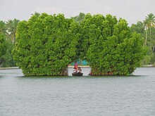
The first community tourism program in the state is being established on the Munroethuruth islands. Backwater tourism is an activity enjoyed in Kollam; Ashtamudi Lake, Paravur, Munroe Island, and Alumkadavu are the main backwater destinations. Accommodation is in resorts and on houseboats.
Thenmala, located 66 kilometres (41 mi) east of Kollam, is the first ecotourism project in India and run by the Thenmala Ecotourism Promotion Society.[31][32][33]
Kollam was the seat of the Desinganad kings. Kottarakara is well known as the place where a new version of the classical dance form of Kathakali was conceived. It was also the capital of the Elayidath Swaroopam. Kundara is known for the 1812 proclamation against the British by Velu Thampi Dalawa.[28]
Alappad village, located on the seashore, was impacted by the 2004 Indian Ocean earthquake and tsunami. Varkala Beach (also known as Papanasham) is 26 kilometres (16 mi) south of Kollam. The Duriyodana Temple is in Kunnathur Taluk. The Sakthikulangara Dharma Sastha Temple-Sree Ayyappa Swamy Temple is known for its Utsavam in the month of Makaram (between mid-January and mid-February).
Polachira, in Chirakkara Gramapanchayat, is a sightseeing destination. The Anathavalam is near here where one can see domestic elephants, touch and ride them. Mannathippara is at Polachira, 4 kilometres (2.5 mi) south of Chathannoor. Sasthamcotta Lake, about 19 kilometres (12 mi) from Kollam, is the largest freshwater lake in Kerala and a domestic tourist destination.[34] Jetayu Para, a large boulder, is located in Chadayamangalam; it is named for a mythical character in the Ramayana. It is believed that Jatayu fell here, after his failed attempt to stop Ravana.[34][35]
See also[]
- Kollam
- Kollam Junction Railway Station
- Kollam MEMU Shed
- Kollam Port
- Asramam Maidan
- Fatima Mata National College
- Punalur
- Punalur Railway Station
- Punalur Suspension Bridge
- Karunagappalli railway station
- Paravur
- Paravur Railway Station
- Educational Institutions in Kollam District
- Kollam Beach
- Paravur Kayal
- Thazhathu Kulakkada
- Valacode
- Nadakkal
- President's Trophy Boat Race
- Kollam pooram
- List of Sree Narayana Institutions
- List of Hindu temples in Kerala
- Roman Catholic Diocese of Quilon
- University of Kerala
- Protected areas of Kerala
References[]
- ^ Jump up to: a b "Kollam District Level Statistics 2011" (PDF). ecostat.kerala.gov.in. 2012. Archived from the original (PDF) on 2 January 2014. Retrieved 1 January 2014.
- ^ "Kerala | UNDP in India". UNDP.
- ^ Jump up to: a b Covt of kerala website, kollam page Archived 26 April 2009 at the Wayback Machine
- ^ "Official Web Portal of Government of Kerala". Archived from the original on 18 January 2006. Retrieved 8 March 2010.
- ^ "MSN Weather". Archived from the original on 9 October 2009. Retrieved 8 March 2010.
- ^ Decadal Variation In Population Since 1901
- ^ Jump up to: a b c d e "District Census 2011". Census2011.co.in. 2011. Retrieved 30 September 2011.
- ^ US Directorate of Intelligence. "Country Comparison:Population". Retrieved 1 October 2011.
Kuwait 2,595,62
- ^ "2010 Resident Population Data". U. S. Census Bureau. Archived from the original on 19 October 2013. Retrieved 30 September 2011.
Nevada 2,700,551
- ^ "Kollam city population Census". census2011.co.in. Retrieved 16 December 2013.
- ^ "DISTRICT CENSUS HANDBOOK, KOLLAM" (PDF). Census India. Retrieved 16 August 2019.
- ^ Administration page of quilon.com
- ^ "Kerala Assembly Election - 2016". Elections.in. Retrieved 15 January 2020.
- ^ Jump up to: a b "kollam police official website". Archived from the original on 11 January 2016. Retrieved 23 June 2011.
- ^ Jump up to: a b Southern Railway Archived 14 September 2010 at the Wayback Machine
- ^ Jump up to: a b KSRTC official website
- ^ Kollam KSRTC Zone
- ^ Jump up to: a b Kollam railway information
- ^ "56331/ Punalur–Kollam Passenger". India Rail Info. Retrieved 10 November 2016.
- ^ "66309/ Ernakulam–Kollam MEMU". India Rail Info. Retrieved 10 November 2016.
- ^ "Kollam Junction railway station". India Rail Info. Retrieved 10 November 2016.
- ^ "In true Travancore tradition". Express TravelWorld. Retrieved 10 November 2016.
- ^ "Kollam Canal". Archived from the original on 2 April 2015. Retrieved 10 November 2016.
- ^ "Transport - Kollam Corporation". Kollam Municipal Corporation. Retrieved 10 November 2016.
- ^ "Important places enroute - KSWTD". KSWTD. Archived from the original on 4 March 2016. Retrieved 10 November 2016.
- ^ "Jhankar Service Opened - The New Indian Express". The New Indian Express. Retrieved 10 November 2016.
- ^ http://www.cashewcorporation.com
- ^ Jump up to: a b "Archived copy". Archived from the original on 6 May 2019. Retrieved 19 February 2020.CS1 maint: archived copy as title (link)
- ^ Jump up to: a b c "kera prd site". Archived from the original on 26 June 2014. Retrieved 5 March 2010.
- ^ Jump up to: a b Kerala matsyafed Archived 26 April 2009 at the Wayback Machine
- ^ Thenmala Ecotourism website
- ^ Thenmala Ecotourism news Hindu Daily
- ^ "Thenmala Ecotourism news Hindu Daily". Archived from the original on 6 June 2011. Retrieved 22 February 2010.
- ^ Jump up to: a b tourism page of Kollam official website Archived 5 May 2017 at the Wayback Machine.
- ^ Jatayu para article from Hindu Daily t.
Further reading[]
- U. Sivaraman Nair (1952), 1951 Census Handbook- Quilon District (PDF), Trivandrum: Travancore-Cochin Government Press
- M. K. Devassy (1965), 1961 Census Handbook- Quilon District (PDF), Directorate of Census Operations, Kerala and The Union Territory of Laccadive, Minicoy, and Amindivi Islands
- Government of India (2014–15), District Census Handbook - Kollam (Part-A) 2011 (PDF), Directorate of Census Operations, Kerala
- Government of India (2014–15), District Census Handbook - Kollam (Part-B) 2011 (PDF), Directorate of Census Operations, Kerala
External links[]
| Wikimedia Commons has media related to Kollam district. |
| show Articles Related to Kollam district |
|---|


| show Authority control |
|---|
- Kollam district
- Districts of Kerala