Kolsdalen
Kolsdalen | |
|---|---|
Neighborhood in Kristiansand | |
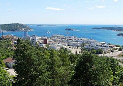 View of the neighborhood | |
 Kolsdalen Location of the neighborhood | |
| Coordinates: 58°08′22″N 7°57′58″E / 58.1394°N 07.9661°ECoordinates: 58°08′22″N 7°57′58″E / 58.1394°N 07.9661°E | |
| Country | Norway |
| County | Agder |
| Municipality | Kristiansand |
| Borough | Grim |
| District | Tinnheia |
| Time zone | UTC+01:00 (CET) |
| • Summer (DST) | UTC+02:00 (CEST) |
| Postal code | 4629 |
| Area code | 38 |


Kolsdalen is a neighbourhood in the city of Kristiansand in Agder county, Norway. It is located in the borough of Grim and in the district of Tinnheia. It lies along the European route E39 highway, south of Kolsberg and east of Hannevika.[1]
References[]
- ^ "Kristiansand Kommune - Høietun". kristiansand.kommune.no. Archived from the original on 2015-07-09. Retrieved 2015-01-01.
| ||
Categories:
- Geography of Kristiansand
- Neighbourhoods of Kristiansand