Kombat
Kombat | |
|---|---|
Mining settlement | |
 Kombat Location in Namibia | |
| Coordinates: 19°43′S 17°43′E / 19.717°S 17.717°E | |
| Country | |
| Region | Otjozondjupa Region |
| Established | 1900 |
| Time zone | UTC+2 (South African Standard Time) |
| Climate | BSh |

Kombat (the place of the giraffe[citation needed]) is a mine and its associated settlement at the southern margin of the in northern Namibia. It is situated 37 kilometres (23 mi) East of Otavi on the B8 to Grootfontein.[1] Kombat at its peak had over 1,000 inhabitants. As of 2015 it is almost abandoned, although Kombat Primary School still operates at reduced capacity, and a clinic is serving the remaining inhabitants.[2]
Minerals were discovered near Kombat in 1850. Around the year 1900, Kombat Mine was opened to extract copper.[1] It was operated by Tsumeb Corporation Limited until the 1970s and by Ongopolo Mining as from 1999. In 2006 Ongopolo and the mine were taken over by PLC, a mining house based in London. Soon thereafter in 2007 the mine flooded, was abandoned, and has been dormant since. In 2015 Namibian businessman acquired the town and the mine for 50 million N$, allegedly with the intention of re-selling it to the Namibian government at a handsome profit.[3][2]

Besides copper, there are sizeable deposits of lead and silver.[3] The mine is known for a host of rare minerals, including glaucochroite.[1]
In the vicinity, Welwitchia Health Training Center brought life to the known ghost town of Kombat. It offers Bachelors of Nursing Science program, Enrolled Nursing Science and Midwifery as well as Bachelor of Information and Communication Technology.
There are also recreational facilities such as Kombat Lodge where visitors and people of the town can enjoy themselves.
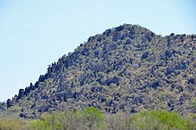
Carbonate rocks at Kombat (2014)

References[]
- ^ Jump up to: a b c "Kombat Mine, Kombat, Grootfontein District, Otjozondjupa Region, Namibia". Mineralogy Database. Retrieved 18 October 2012.
- ^ Jump up to: a b Kahiurika, Ndankie (28 October 2015). "A ghost town called Kombat". The Namibian.
- ^ Jump up to: a b Neethling, Andre (5 May 2011). "What is happening at Kombat?". Namibian Sun. Archived from the original on 29 January 2013. Retrieved 18 October 2012.
Coordinates: 19°43′S 17°43′E / 19.717°S 17.717°E
This Namibia location article is a stub. You can help Wikipedia by . |
- Populated places in the Otjozondjupa Region
- Mining in Namibia
- Populated places established in 1900
- 1900 establishments in German South West Africa
- Mining communities in Africa
- Namibia geography stubs