Kompienga Province
Kompienga | |
|---|---|
Province | |
 Location in Burkina Faso | |
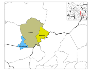 Provincial map of its departments | |
| Coordinates: Coordinates: 11°25′N 0°55′E / 11.417°N 0.917°E | |
| Country | |
| Region | Est Region |
| Capital | Pama |
| Area | |
| • Province | 6,998 km2 (2,702 sq mi) |
| Population (2019 census)[1] | |
| • Province | 117,672 |
| • Density | 17/km2 (44/sq mi) |
| • Urban | 13,579 |
| Time zone | UTC+0 (GMT 0) |

Kompienga is one of the 45 provinces of Burkina Faso, located in its Est Region.
The capital of Kompienga is Pama. The province also borders the country of Togo. The Kompienga Dam located in the province is the country's first hydro-electric dam and is responsible for much of Ouagadougou's electricity supply.[2]
Departments[]

| Department | Capital city | Population (Census 2006)[3] |
|---|---|---|
| Kompienga Department | Kompienga | 29,609 |
| Madjoari Department | 9,550 | |
| Pama Department | Pama | 36,503 |
See also[]
References[]
- ^ Citypopulation.de Population of provinces in Est Region
- ^ Manson, K.; Knight (2006). "IV: The East". Burkina Faso. Bradt Travel Guides, The Globe Pequot Press Inc. p. 196. ISBN 1841621544. Retrieved June 17, 2008.
- ^ "National 2006 census preliminary results" (PDF). Archived from the original (PDF) on 2015-07-21. Retrieved 2014-10-16.
This Kompienga Province location article is a stub. You can help Wikipedia by . |
Categories:
- Kompienga Province
- Provinces of Burkina Faso
- Est Region, Burkina Faso, geography stubs