Kondopoga
Kondopoga
Кондопога | |
|---|---|
Town[1] | |
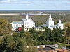
 Kondopoga Lotos Mall surroundings | |
 Coat of arms | |
show Location of Kondopoga | |
 Kondopoga Location of Kondopoga | |
| Coordinates: 62°12′N 34°17′E / 62.200°N 34.283°ECoordinates: 62°12′N 34°17′E / 62.200°N 34.283°E | |
| Country | Russia |
| Federal subject | Republic of Karelia[1] |
| Administrative district | Kondopozhsky District[1] |
| First mention | 1563[2] |
| Town status since | 1938 |
| Elevation | 60 m (200 ft) |
| Population | |
| • Total | 32,987 |
| • Estimate (2018)[4] | 30,299 (−8.1%) |
Administrative status | |
| • Capital of | Kondopozhsky District[1] |
Municipal status | |
| • Municipal district | Kondopozhsky Municipal District[5] |
| • Urban settlement | Kondopozhskoye Urban Settlement[5] |
| • Capital of | Kondopozhsky Municipal District[6], Kondopozhskoye Urban Settlement[5] |
| Time zone | UTC+3 (MSK |
| Postal code(s)[8] | 186220–186225 |
| Dialing code(s) | +7 81451 |
| OKTMO ID | 86615101001 |
| Website | www |


Kondopoga (Russian: Ко́ндопога; Karelian: Kondupohju; Finnish: Kontupohja) is a town and the administrative center of Kondopozhsky District of the Republic of Karelia, Russia, located by the northern tip of the Kondopoga Bay of Lake Onega, near the mouth of the Suna River and Kivach Nature Reserve, about 54 kilometers (34 mi) from Petrozavodsk. Population: 32,987 (2010 Census);[3] 34,863 (2002 Census);[9] 36,365 (1989 Census).[10]
History[]
Tsardom of Russia 1563–1721
Russian Empire 1721–1917
Soviet Russia 1917–1922
Soviet Union 1922–1941
Republic of Finland 1941–1944
Soviet Union 1944–1991
The very first written reference to Kondopoga dates back to 1563.[2] It became important after rich marble deposits were discovered nearby in 1757 and the quarries were founded. Kondopoga became a logistics hub for marble shipping to St. Petersburg. Later, iron ore deposits were found in the vicinity, which were shipped to metallurgical factories in Petrozavodsk and in .
By 1892, Kondopoga had forty-eight buildings, three hundred inhabitants, two churches, and a college and held an annual trade fair on September 8–15.
During World War I, the Main Artillery Administrative Department of the Russian Military Ministry started construction of a nitric acid plant there, which was essential for gunpowder production. A hydroelectric power station was designed to meet considerable demand in the energy for such a plant. Kondopoga was well suitable for such a station due to significant water level drop between and Onega. A 30 MW station was to become the largest in Russia. However, the October Revolution and the subsequent Civil War delayed the project, which was only revived in the Soviet time as a part of the GOELRO plan. According to the project, the waters of the Suna River were to be redirected towards the hydroelectric power station via the lake system. On July 19, 1923, Sovnarkhoz of Karelia ratified the formation of a building society (Kondostroy) to build a hydroelectric power station and a major pulp and paper mill. Kondopoga became the administrative center of a district in 1932 and was granted town status in 1938.[citation needed] At the time, its population was about fourteen thousand inhabitants.
On November 3, 1941, during World War II, Kondopoga was occupied by Finnish troops and totally destroyed. Industrial plants and factories were looted, including the pulp and paper mill, hydroelectric station, granite and brick factories, furniture factory, and other facilities. Approximately 250 houses and apartment buildings were demolished along with concert halls, museums, kindergarten, school, hotels, fire station, and government offices. All bridges in the vicinity were blown up. The town was liberated on June 28, 1944 by Red Army's Karelian Front as part of Svir–Petrozavodsk Offensive. After the war, the town was rebuilt. In 1957, Kondopoga was declared the All-Union Komsomol building site. A number of new factories were built and the pulp and paper mill was also expanded. The population grew to 38,000 people.
On the night of August 29–30, 2006, two ethnic Russians were killed and several others badly injured by Chechens, starting 2006 ethnic tensions in Kondopoga.
Administrative and municipal status[]
Within the framework of administrative divisions, Kondopoga serves as the administrative center of Kondopozhsky District, to which it is directly subordinated.[1] As a municipal division, the town of Kondopoga, together with three rural localities, is incorporated within Kondopozhsky Municipal District as Kondopozhskoye Urban Settlement.[5]
Economy and transportation[]
Kondopoga has a railway station on the Moscow–Murmansk railroad, some of the largest pulp and paper mills in Eastern Europe (e.g. OAO Kondopoga), a medical college, and facilities for the manufacture of building materials.
The Blue Highway, an international tourist route, starts in Mo i Rana, Norway, goes through Sweden and Finland, and then through Kondopoga, before ending in Pudozh.
Architecture[]

First recorded as early as 1495, Kondopoga retained a rare monument of Russian wooden architecture — the Dormition Church (Успенская церковь), built in 1774. The central column of this church was crowned by a hipped roof, 42 m in total height. The column was based on a central rectangular framework, with adjacent frameworks for the refectory and altar. The altar framework was covered by a traditional wooden roof, called a barrel roof.
The church was burnt up in 2018 by a mentally disordered teenager, only few charred remains left at its place.
References[]
Notes[]
- ^ Jump up to: a b c d e Law #871-RZK
- ^ Jump up to: a b "Kondopoga: History". Retrieved July 25, 2013.
- ^ Jump up to: a b Russian Federal State Statistics Service (2011). Всероссийская перепись населения 2010 года. Том 1 [2010 All-Russian Population Census, vol. 1]. Всероссийская перепись населения 2010 года [2010 All-Russia Population Census] (in Russian). Federal State Statistics Service.
- ^ "26. Численность постоянного населения Российской Федерации по муниципальным образованиям на 1 января 2018 года". Federal State Statistics Service. Retrieved January 23, 2019.
- ^ Jump up to: a b c d Law #813-RZK
- ^ Law #825-ZRK
- ^ "Об исчислении времени". Официальный интернет-портал правовой информации (in Russian). June 3, 2011. Retrieved January 19, 2019.
- ^ Почта России. Информационно-вычислительный центр ОАСУ РПО. (Russian Post). Поиск объектов почтовой связи (Postal Objects Search) (in Russian)
- ^ Russian Federal State Statistics Service (May 21, 2004). Численность населения России, субъектов Российской Федерации в составе федеральных округов, районов, городских поселений, сельских населённых пунктов – районных центров и сельских населённых пунктов с населением 3 тысячи и более человек [Population of Russia, Its Federal Districts, Federal Subjects, Districts, Urban Localities, Rural Localities—Administrative Centers, and Rural Localities with Population of Over 3,000] (XLS). Всероссийская перепись населения 2002 года [All-Russia Population Census of 2002] (in Russian).
- ^ Всесоюзная перепись населения 1989 г. Численность наличного населения союзных и автономных республик, автономных областей и округов, краёв, областей, районов, городских поселений и сёл-райцентров [All Union Population Census of 1989: Present Population of Union and Autonomous Republics, Autonomous Oblasts and Okrugs, Krais, Oblasts, Districts, Urban Settlements, and Villages Serving as District Administrative Centers]. Всесоюзная перепись населения 1989 года [All-Union Population Census of 1989] (in Russian). Институт демографии Национального исследовательского университета: Высшая школа экономики [Institute of Demography at the National Research University: Higher School of Economics]. 1989 – via Demoscope Weekly.
Sources[]
- Законодательное Собрание Республики Карелия. Закон №871-ЗРК от 29 апреля 2005 г. «Об административно-территориальном устройстве Республики Карелия», в ред. Закона №1895-ЗРK от 2 июня 2015 г. «О внесении изменения статью 9 Закона Республики Карелия "Об административно-территориальном устройстве Республики Карелия"». Вступил в силу со дня официального опубликования. Опубликован: газета "Карелия", №48, 7 мая 2005 г. (Legislative Assembly of the Republic of Karelia. Law #871-ZRK of April 29, 2005 On the Administrative-Territorial Structure of the Republic of Karelia, as amended by the Law #1895-ZRK of June 2, 2015 On Amending Article 9 of the Law of the Republic of Karelia "On the Administrative-Territorial Structure of the Republic of Karelia". Effective as of the official publication date.).
- Законодательное Собрание Республики Карелия. Закон №813-ЗРК от 1 ноября 2004 г. «О городских, сельских поселениях в Республике Карелия», в ред. Закона №1694-ЗРK от 2 апреля 2013 г. «О преобразовании муниципальных образований "Нюхчинское сельское поселение" и "Сумпосадское сельское поселение" Беломорского муниципального района и внесении изменений в некоторые законодательные акты Республики Карелия». Вступил в силу по истечении десяти дней со дня официального опубликования. Опубликован: газета "Карелия", №124, 126, 129, 132, 135, 136, 139, 4 ноября — 9 декабря 2004 г. (Legislative Assembly of the Republic of Karelia. Law #813-ZRK of November 1, 2004 On the Urban, Rural Settlements in the Republic of Karelia, as amended by the Law #1694-ZRK of April 2, 2013 On the Transformation of the Municipal Formations of "Nyukhchinskoye Rural Settlement" and "Sumposadskoye Rural Settlement" of Belomorsky Municipal District of the Republic of Karelia and on Amending Various Legislative Acts of the Republic of Karelia. Effective as of the day which is ten days after the day of the official publication.).
- Законодательное Собрание Республики Карелия. Закон №825-ЗРК от 1 декабря 2004 г. «О муниципальных районах в Республике Карелия», в ред. Закона №1694-ЗРK от 2 апреля 2013 г. «О преобразовании муниципальных образований "Нюхчинское сельское поселение" и "Сумпосадское сельское поселение" Беломорского муниципального района и внесении изменений в некоторые законодательные акты Республики Карелия». Вступил в силу по истечении десяти дней со дня официального опубликования. Опубликован: газета "Карелия", №141, 16 декабря 2004 г. (Legislative Assembly of the Republic of Karelia. Law #825-ZRK of December 1, 2004 On the Municipal Districts in the Republic of Karelia, as amended by the Law #1694-ZRK of April 2, 2013 On the Transformation of the Municipal Formations of "Nyukhchinskoye Rural Settlement" and "Sumposadskoye Rural Settlement" of Belomorsky Municipal District of the Republic of Karelia and on Amending Various Legislative Acts of the Republic of Karelia. Effective as of the day which is ten days after the day of the official publication.).
External links[]
- Cities and towns in the Republic of Karelia
- Petrozavodsky Uyezd
- Populated lakeshore places in Russia
- Monotowns in Russia