Konopiska
Konopiska | |
|---|---|
Village | |
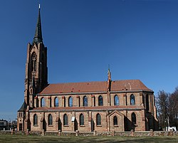 Church of Saints Valentine and Lawrence | |
 Flag | |
 Konopiska | |
| Coordinates: 50°43′32″N 19°0′30″E / 50.72556°N 19.00833°ECoordinates: 50°43′32″N 19°0′30″E / 50.72556°N 19.00833°E | |
| Country | |
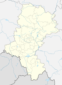
| Voivodeship | |
| County | Częstochowa County |
| Gmina | Konopiska |
| Population | |
| • Total | 2,901 |


Konopiska [kɔnɔˈpiska] is a village in Częstochowa County, Silesian Voivodeship, in southern Poland. It is the seat of the gmina (administrative district) called Gmina Konopiska.[1] It lies approximately 12 kilometres (7 mi) south-west of Częstochowa and 53 km (33 mi) north of the regional capital Katowice.
The village has a population of 2,901.
References[]
| hide | ||
|---|---|---|
| Seat |  | |
| Other villages | ||
| Authority control |
|---|
This Częstochowa County location article is a stub. You can help Wikipedia by . |
Categories:
- Villages in Częstochowa County
- Częstochowa County geography stubs