Konradsreuth
Konradsreuth | |
|---|---|
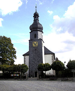 Lutheran church | |
 Coat of arms | |
show Location of Konradsreuth within Hof district | |
 Konradsreuth | |
| Coordinates: 50°16′N 11°50′E / 50.267°N 11.833°ECoordinates: 50°16′N 11°50′E / 50.267°N 11.833°E | |
| Country | Germany |
| State | Bavaria |
| Admin. region | Oberfranken |
| District | Hof |
| Government | |
| • Mayor (2020–26) | Matthias Döhla[1] (SPD) |
| Area | |
| • Total | 43.32 km2 (16.73 sq mi) |
| Elevation | 552 m (1,811 ft) |
| Population (2020-12-31)[2] | |
| • Total | 3,143 |
| • Density | 73/km2 (190/sq mi) |
| Time zone | UTC+01:00 (CET) |
| • Summer (DST) | UTC+02:00 (CEST) |
| Postal codes | 95176 |
| Dialling codes | 09292 |
| Vehicle registration | HO |
| Website | www.konradsreuth.de |


Konradsreuth is a municipality in Upper Franconia in the district of Hof in Bavaria in Germany.
Geography[]
The districts[]
With the local government reorganization in 1972, the following villages were merged into Konradsreuth municipality:
| Ahornberg | Berg | Birkenhof | Brand | Eckardsreuth | Engel |
| Frauenhof | Föhrenreuth | Glänzlamühle | Gläsel | Gottschalk | Hollareuth |
| Jägerhaus | Klausenhof | Konradsreuth | Lerchenberg | Martinsreuth | Maschinenhaus (Waldlust) |
| Modlitz | Neudörflein | Oberpferdt | Pretschenreuth | Reuthlas | Ringlasmühle |
| Schallershof | Schallersreuth | Schwarzenfurth | Schödelshöhe | Silberbach | Steinmühle |
| Stiftsgrün | Unterpferdt | Walburgisreuth | Weißlenreuth | Wendlershof | Wölbersbach |
References[]
- ^ Liste der ersten Bürgermeister/Oberbürgermeister in kreisangehörigen Gemeinden, Bayerisches Landesamt für Statistik, 15 July 2021.
- ^ "Tabellenblatt "Daten 2", Statistischer Bericht A1200C 202041 Einwohnerzahlen der Gemeinden, Kreise und Regierungsbezirke". Bayerisches Landesamt für Statistik (in German). June 2021.
| show Towns and municipalities in Hof (district) |
|---|
| show Authority control |
|---|
This Hof district location article is a stub. You can help Wikipedia by . |
Categories:
- Municipalities in Bavaria
- Hof (district)
- Upper Franconia geography stubs