Kosrae International Airport
This article does not cite any sources. (October 2019) |
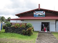
Kosrae International Airport | |||||||||||
|---|---|---|---|---|---|---|---|---|---|---|---|
 | |||||||||||
| Summary | |||||||||||
| Airport type | Public | ||||||||||
| Location | Okat | ||||||||||
| Elevation AMSL | 11 ft / 3 m | ||||||||||
| Coordinates | 05°21′25″N 162°57′30″E / 5.35694°N 162.95833°ECoordinates: 05°21′25″N 162°57′30″E / 5.35694°N 162.95833°E | ||||||||||
| Map | |||||||||||
 Kosrae International Airport | |||||||||||
| Runways | |||||||||||
| |||||||||||

Kosrae International Airport (IATA: KSA, ICAO: PTSA, FAA LID: TTK) is an airport serving Kosrae, the easternmost state of the Federated States of Micronesia. It is located on an artificial island within the fringing reef about 150 meters from the coast and is connected to the main island by a causeway.
The airport has been continuously served by the United Airlines (formerly Continental Micronesia) Island Hopper service between Guam and Honolulu, which stops twice weekly at Kosrae in each direction. Kosrae is three jogs from both Guam and Honolulu. As of June 2015, Nauru Airlines stops at Kosrae once a week in each direction between Nauru and Chuuk.
Airlines and destinations[]
| Airlines | Destinations |
|---|---|
| Caroline Islands Air | Charter: Pohnpei |
| United Airlines | Chuuk, Guam, Honolulu, Kwajalein, Majuro, Pohnpei |
See also[]
- Island Hopper scheduled air service
References[]
External links[]
- Kosrae Visitors Center: Jewel of Micronesia
- AirNav.com: FAA information for PTSA
- CrusingAltitude.com's photo essay of KSA
- Photos of Kosrae
This Federated States of Micronesia location article is a stub. You can help Wikipedia by . |
This article about an Oceanian airport is a stub. You can help Wikipedia by . |
- Airports in the Federated States of Micronesia
- Kosrae
- Federated States of Micronesia geography stubs
- Oceanian airport stubs