Kothavalasa
Kothavalasa | |
|---|---|
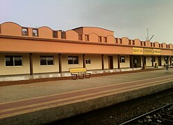 Kothavalasa Train Station | |
 Kothavalasa Location in Andhra Pradesh, India | |
| Coordinates: 17°54′N 83°12′E / 17.9°N 83.2°ECoordinates: 17°54′N 83°12′E / 17.9°N 83.2°E | |
| Country | India |
| State | Andhra Pradesh |
| District | Vizianagaram |
| Area | |
| • Total | 7.60 km2 (2.93 sq mi) |
| Elevation | 209 m (686 ft) |
| Population (2011) | |
| • Total | 14,321 |
| • Density | 1,900/km2 (4,900/sq mi) |
| Languages | |
| • Official | Telugu |
| Time zone | UTC+5:30 (IST) |
| PIN | 535183 |
| Vehicle Registration | AP35 (Former) AP39 (from 30 January 2019)[2] |

Kothavalasa is a Suburb in Visakhapatnam city but present in Vizianagaram district of the Indian state of Andhra Pradesh. It is located in Kothavalasa mandal of Vizianagaram revenue division. It is located 30 km from the city of Visakhapatanam [1]

Geography[]
Kothavalasa is located at 17°54′N 83°12′E / 17.9°N 83.2°E.[3] It has an average elevation of 209 meters (688 feet).
Transport[]
Kothavalasa has a railway station which is under jurisdiction of East Coast Railway.
Demographics[]
As of 2001 India census,[4] Kothavalasa had a population of 15,298. Males constitute 50% of the population and females 50%. Kothavalasa has an average literacy rate of 69%, higher than the national average of 59.5%: male literacy is 76%, and female literacy is 62%. In Kothavalasa, 12% of the population is under 6 years of age.
Kothavalasa mandal had a population of 62,841 in 2001. Males consists of 31,428 and females 31,413 (M:E ratio=1:1) of the population. The average literacy rate of the mandal population is 60%. Male literacy rate is 72% and that of females 48%.
Education[]
The primary and secondary school education is imparted by government, aided and private schools, under the School Education Department of the state.[5][6] The medium of instruction followed by different schools are English, Telugu.
See also[]
- Kothavalasa railway station
References[]
- ^ Jump up to: a b "District Census Handbook - Vizianagaram" (PDF). Census of India. p. 18–19,350. Retrieved 5 December 2015.[permanent dead link]
- ^ "New 'AP 39' code to register vehicles in Andhra Pradesh launched". The New Indian Express. Vijayawada. 31 January 2019. Retrieved 9 June 2019.
- ^ Falling Rain Genomics.Kottavalasa
- ^ "Census of India 2001: Data from the 2001 Census, including cities, villages and towns (Provisional)". Census Commission of India. Archived from the original on 16 June 2004. Retrieved 1 November 2008.
- ^ "School Education Department" (PDF). School Education Department, Government of Andhra Pradesh. Archived from the original (PDF) on 27 December 2015. Retrieved 7 November 2016.
- ^ "The Department of School Education - Official AP State Government Portal | AP State Portal". www.ap.gov.in. Archived from the original on 7 November 2016. Retrieved 7 November 2016.
- Census towns in Andhra Pradesh
- Mandal headquarters in Vizianagaram district
- Neighbourhoods in Visakhapatnam