Kotido Airport
Kotido Airport | |||||||||||
|---|---|---|---|---|---|---|---|---|---|---|---|
| Summary | |||||||||||
| Airport type | Public | ||||||||||
| Serves | Kotido, Uganda | ||||||||||
| Elevation AMSL | 4,070 ft / 1,241 m | ||||||||||
| Coordinates | 2°57′10″N 34°07′22″E / 2.95278°N 34.12278°ECoordinates: 2°57′10″N 34°07′22″E / 2.95278°N 34.12278°E | ||||||||||
| Map | |||||||||||
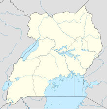 HUKO Location of the airport in Uganda | |||||||||||
| Runways | |||||||||||
| |||||||||||

Kotido Airport (ICAO: HUKO) is a small civilian airport that serves the town of Kotido in Uganda. The airport is 6 kilometres (3.7 mi) south of the town and has a single unpaved runway.
See also[]
 Uganda portal
 Aviation portal
- Civil Aviation Authority of Uganda
- Transport in Uganda
- List of airports in Uganda
References[]
External links[]
- Uganda Civil Aviation Authority Homepage
- OurAirports - Kotido
- FallingRain - Kotido Airport
- Airport information for HUKO at Great Circle Mapper.
Capital: Kotido | ||
| Towns and villages |  | |
| Economy |
| |
| Notable landmarks | ||
| Health |
| |
| Transport |
| |
This article about an airport in Uganda is a stub. You can help Wikipedia by . |
Categories:
- Airports in Uganda
- Kotido District
- East African airport stubs
- Ugandan building and structure stubs