Kottenforst
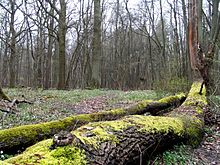
The Kottenforst is a large forest, about 40 km² in area, to the south, west and north of the city of Bonn in Germany. It is part of the Rhineland Nature Park (1,045 km²) and forms its eastern side.
Geography[]
The Kottenforst is the southern part of a highland region that lies about 150 to 180 m above sea level (NHN), and known as the , which drops steeply towards the east into the Rhine Valley, but whose western slopes descend more gradually towards the Swist and Erft rivers, forming a geological half-horst. The part of the natural region of Ville, which is not dominated by the brown coal mining of the , is also called Waldville.
The Kottenforst is divided into a southeastern section between Meckenheim, Bad Godesberg and Bonn, into which areas of natural open country intrude in places, such as the , and a northern area between Heimerzheim, Buschhoven and Alfter. Between the two areas lies the village of .
References[]
Literature[]
- Werner D´hein: Kottenforst. 13 Wanderungen durch eine historische Kulturlandschaft. Gaasterland-Verlag, Düsseldorf, 2008, ISBN 978-3-935873-21-5.
- Bruno P. Kremer (also ed.): Der Kottenforst. Eine rheinische Kultur- und Erholungslandschaft. Wienand, Cologne, 1999, ISBN 3-87909-648-1.
- Albert Hexges: Der Kottenforst. Ein Beitrag zur Forstgeschichte Kurkölns unter besonderer Berücksichtigung der Entwicklung des Waldeigentums, des Forstrechts, der Forstorganisation und der Waldnutzung. In: Bonner Geschichtsblätter, Band 35. Bonn, 1984, pp. 23–98.
- Gemeinde Swisttal, Heinz Doepgen (ed.): 900 Jahre Heimerzheim. G. Grote'sche Verlagsbuchhandlung, Cologne and Berlin, ISBN 3-7745-6333-0.
- Arbeitskreis Heimat im Ortsausschuss Heimerzheim (ed.): Heimerzheim im Wandel der Zeiten.
Sources[]
- Nature park map 1:50,000 by the of NRW Kottenforst-Ville, and the hiking map of the Eifel Club in cooperation with the of Kottenforst, 1980 (with description on the reverse side)
External links[]
| Wikimedia Commons has media related to Kottenforst. |
Coordinates: _region:DE-NW 50°40′04″N 7°01′22″E / 50.6677°N 07.0227°E

| Authority control |
|---|
- Forests and woodlands of North Rhine-Westphalia
- Rhein-Sieg-Kreis
- Bonn